1955 Map of Sperry
USGS Topo · Published 1975About this map
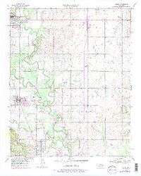
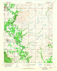
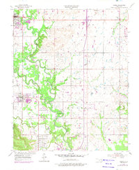
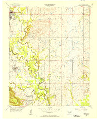
The Bird Creek valley north of Tulsa defines this mid-century landscape, where the meandering waterway creates complex landforms like Horseshoe Bend. The map documents a region heavily influenced by the petroleum industry, featuring the extensive Skiatook Oil Field and Owasso Oil Field, marked by numerous oil and gas wells. Settlement patterns are anchored by Skiatook, Sperry, and Turley, with the Texas and Pacific railroad providing the primary transportation corridor through the creek flats.
Find a feature on this map
25 named features on this map. Tap any name to fly to it.
Don’t see what you’re looking for? This feature index may not catch every label — zoom into the map to look around manually.
Map Details
Editions of this 1955 Sperry Map
4 editions found
Other maps of this area

1901 · Claremore
USGS Topo · 1:125,000

1912 · Hominy
USGS Topo · 1:125,000

1914 · Claremore
USGS Topo · 1:125,000

1915 · Hominy
USGS Topo · 1:125,000

1916 · Claremore
USGS Topo · 1:125,000

1954 · Tulsa
USGS Topo · 1:250,000

1954 · Tulsa
USGS Topo · 1:24,000
1955 · Sperry
USGS Topo · 1:24,000

1955 · Mingo
USGS Topo · 1:24,000

1955 · Enid
USGS Topo · 1:250,000