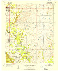
1955 Map of Sperry
USGS Topo · Published 1956About this map
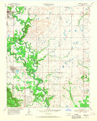
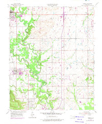
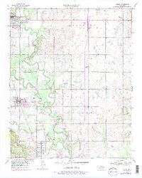
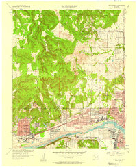
Bird Creek and Hominy Creek converge in this mid-century landscape, carving deep meanders across the border of Osage and Tulsa counties. The terrain is heavily defined by the regional energy economy, with dense clusters of oil wells and infrastructure marking the Skiatook Field and Owasso Field. Transportation is anchored by the Midland Valley railroad, which links the established settlements of Skiatook, Sperry, and Turley. Local history is preserved through numerous family and community burial grounds, including the Chisholm, Skybuck, and Charley cemeteries. A specialized view of the era's social and technical landscape is visible through features like the drive-in theater near Cherry Creek and the gaging station at Horseshoe Bend.
Find a feature on this map
27 named features on this map. Tap any name to fly to it.
Don’t see what you’re looking for? This feature index may not catch every label — zoom into the map to look around manually.
Map Details
Editions of this 1955 Sperry Map
4 editions found
Other maps of this area

1901 · Claremore
USGS Topo · 1:125,000

1912 · Hominy
USGS Topo · 1:125,000

1914 · Claremore
USGS Topo · 1:125,000

1915 · Hominy
USGS Topo · 1:125,000

1916 · Claremore
USGS Topo · 1:125,000

1954 · Tulsa
USGS Topo · 1:250,000

1954 · Tulsa
USGS Topo · 1:24,000

1955 · Mingo
USGS Topo · 1:24,000

1955 · Enid
USGS Topo · 1:250,000
1956 · Sand Springs
USGS Topo · 1:24,000