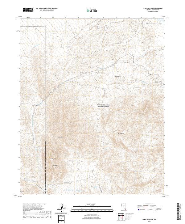
2021 Map of Spirit Mountain
USGS Topo · Published 2021About this map
Spirit Mtn and the surrounding Newberry Mountains dominate this high-desert landscape in southern Clark County. The topography is defined by significant drainage systems such as Empire Wash, Nellis Wash, and Roman Wash, which cut through the arid terrain of the Mojave Desert. Within the Lake Mead National Recreation Area, several critical water sources are identified, including Roman Spring, Pipe Spring, and Discovery Spring, highlighting the survival resources of this environment. Access into these peaks is traced via Christmas Tree Pass Rd and Pipe Spring Rd, which provide passage near landmarks like Devils Thumb and North Peak. The map captures the remote character of the region, emphasizing the geologic formations of Grapevine Canyon and the natural corridors leading toward Cottonwood Valley.
Find a feature on this map
28 named features on this map. Tap any name to fly to it.
Don’t see what you’re looking for? This feature index may not catch every label — zoom into the map to look around manually.
Map Details
Editions of this 2021 Spirit Mountain Map
This is the sole edition of this map. No revisions or reprints were ever made.
Other maps of this area

1886 · Camp Mohave
USGS Topo · 1:250,000

1892 · Camp Mohave
USGS Topo · 1:250,000

1926 · Mohave City
USGS Topo · 1:96,000

1942 · Camp Mohave
USGS Topo · 1:250,000

1947 · Kingman
USGS Topo · 1:250,000

1948 · Kingman
USGS Topo · 1:250,000

1950 · Davis Dam
USGS Topo · 1:62,500

1952 · Davis Dam
USGS Topo · 1:62,500

1954 · Kingman
USGS Topo · 1:250,000

1955 · Kingman
USGS Topo · 1:250,000