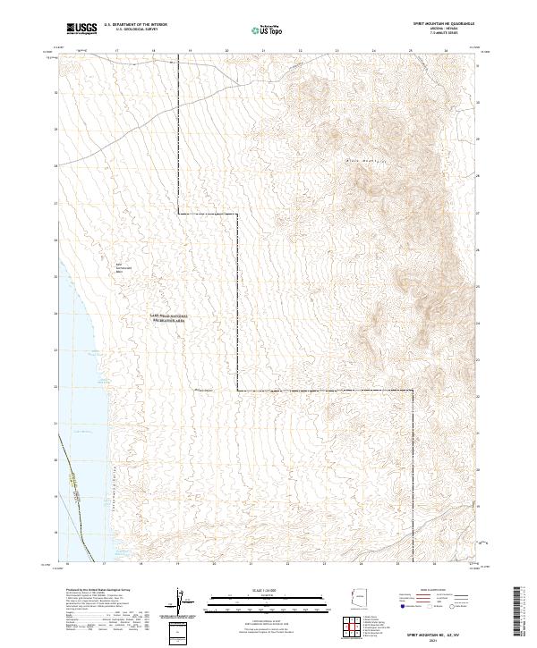
2021 Map of Spirit Mountain NE
USGS Topo · Published 2021About this map
Lake Mead National Recreation Area dominates this section of the Mojave Desert, where the high elevations of the Black Mountains descend toward the Colorado River corridor. The map highlights the complex shoreline of Lake Mohave, defined by a series of named inlets including Black Sheep Cove, Three Mile Cove, and Glory Cove. The terrain is characterized by the broad Cottonwood Valley and the East Cottonwood Basin, showing the transition from mountain slopes to the reservoir edge. The boundary between Clark County, Nevada and Mohave County, Arizona runs through the center of the water, marking the interstate division within this protected landscape. Modern access is primarily represented by Cottonwood Rd, which provides a route through the rugged interior toward the Southern Basin Cove.
Find a feature on this map
16 named features on this map. Tap any name to fly to it.
Don’t see what you’re looking for? This feature index may not catch every label — zoom into the map to look around manually.
Map Details
Editions of this 2021 Spirit Mountain NE Map
This is the sole edition of this map. No revisions or reprints were ever made.
Other maps of this area

1886 · Camp Mohave
USGS Topo · 1:250,000

1892 · Camp Mohave
USGS Topo · 1:250,000

1926 · Nelson
USGS Topo · 1:96,000

1926 · Mohave City
USGS Topo · 1:96,000

1942 · Camp Mohave
USGS Topo · 1:250,000

1947 · Kingman
USGS Topo · 1:250,000

1948 · Kingman
USGS Topo · 1:250,000

1954 · Kingman
USGS Topo · 1:250,000

1955 · Kingman
USGS Topo · 1:250,000

1958 · Kingman
USGS Topo · 1:250,000