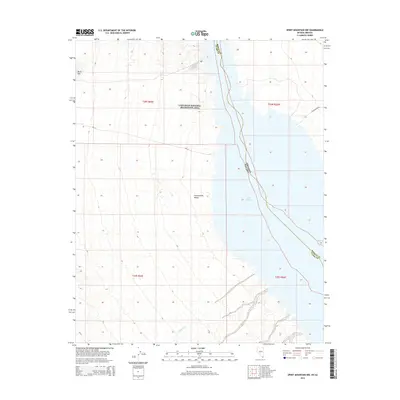
2014 Map of Spirit Mountain NW
USGS Topo · Published 2014About this map
Lake Mohave dominates the eastern edge of this desert landscape, where the waters of the Colorado River are contained along the border of Clark County and Mohave County. Much of the western terrain is defined by the Cottonwood Valley and the rising slopes of Black Mtn, all protected within the expansive boundaries of the Lake Mead National Recreation Area. The map documents a sparsely developed region where natural drainage features like Nellis Wash carve through the arid basin. Connectivity is limited to foundational desert routes such as Cottonwood Rd and Nps 31, illustrating the region's character as a managed wilderness area rather than a center of settlement. This 2014 survey serves as a clear record of the shoreline and topography before any subsequent hydrological or administrative shifts.
Find a feature on this map
13 named features on this map. Tap any name to fly to it.
Don’t see what you’re looking for? This feature index may not catch every label — zoom into the map to look around manually.
Map Details
Editions of this 2014 Spirit Mountain NW Map
This is the sole edition of this map. No revisions or reprints were ever made.
Other maps of this area

1886 · Camp Mohave
USGS Topo · 1:250,000

1892 · Camp Mohave
USGS Topo · 1:250,000

1926 · Nelson
USGS Topo · 1:96,000

1926 · Mohave City
USGS Topo · 1:96,000

1942 · Camp Mohave
USGS Topo · 1:250,000

1947 · Kingman
USGS Topo · 1:250,000

1948 · Kingman
USGS Topo · 1:250,000

1954 · Kingman
USGS Topo · 1:250,000

1955 · Kingman
USGS Topo · 1:250,000

1958 · Kingman
USGS Topo · 1:250,000