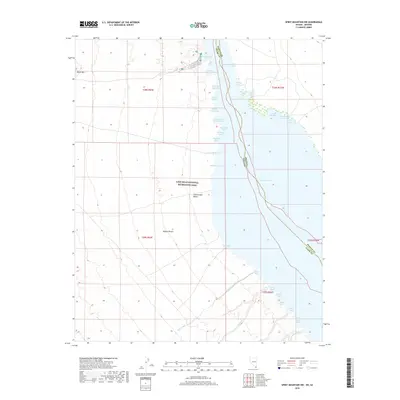
2018 Map of Spirit Mountain NW
USGS Topo · Published 2018About this map
Cottonwood Cove serves as a primary access point to the waters of Lake Mohave on this 2018 survey, situated within the Lake Mead National Recreation Area. The landscape is defined by the sharp contrast between the arid Mojave Desert and the intricate shoreline of the reservoir, which is punctuated by dozens of named inlets such as Ski Cove, Windmill Cove, and Nine Mile Coves. To the west, the terrain rises toward Black Mtn, while Cottonwood Valley and the drainage of Nellis Wash shape the desert floor. This modern record of the Nevada-Arizona border region details the recreational geography of the Colorado River system, showing the placement of campsites and docks alongside landmarks like Water Wheel Cove and Hog Farm Cove that reflect the area's varied human history.
Find a feature on this map
38 named features on this map. Tap any name to fly to it.
Don’t see what you’re looking for? This feature index may not catch every label — zoom into the map to look around manually.
Map Details
Editions of this 2018 Spirit Mountain NW Map
This is the sole edition of this map. No revisions or reprints were ever made.
Other maps of this area

1886 · Camp Mohave
USGS Topo · 1:250,000

1892 · Camp Mohave
USGS Topo · 1:250,000

1926 · Nelson
USGS Topo · 1:96,000

1926 · Mohave City
USGS Topo · 1:96,000

1942 · Camp Mohave
USGS Topo · 1:250,000

1947 · Kingman
USGS Topo · 1:250,000

1948 · Kingman
USGS Topo · 1:250,000

1954 · Kingman
USGS Topo · 1:250,000

1955 · Kingman
USGS Topo · 1:250,000

1958 · Kingman
USGS Topo · 1:250,000