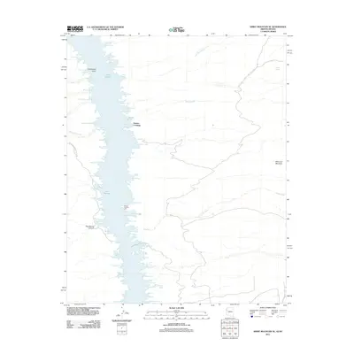
2011 Map of Spirit Mountain SE
USGS Topo · Published 2011About this map
Lake Mohave dominates this landscape, stretching between the steep terrain of the Lake Mead National Rec Area. The map reveals a complex shoreline defined by dozens of small inlets and coves named for prospectors, local landmarks, and natural features, such as Camp Thurman Cove, Forty-Niner Cove, and the oddly named Eighty-Three Dollar Cove. Centered around Mohave Crossing, the waterway serves as a vital corridor marked by the Mohave Crossing Light, reflecting the importance of river navigation even as modern recreation has reshaped the valley.
Find a feature on this map
63 named features on this map. Tap any name to fly to it.
Don’t see what you’re looking for? This feature index may not catch every label — zoom into the map to look around manually.
Map Details
Editions of this 2011 Spirit Mountain SE Map
This is the sole edition of this map. No revisions or reprints were ever made.
Other maps of this area

1886 · Camp Mohave
USGS Topo · 1:250,000

1892 · Camp Mohave
USGS Topo · 1:250,000

1926 · Mohave City
USGS Topo · 1:96,000

1942 · Camp Mohave
USGS Topo · 1:250,000

1947 · Kingman
USGS Topo · 1:250,000

1948 · Kingman
USGS Topo · 1:250,000

1950 · Davis Dam
USGS Topo · 1:62,500

1952 · Davis Dam
USGS Topo · 1:62,500

1954 · Kingman
USGS Topo · 1:250,000

1955 · Kingman
USGS Topo · 1:250,000