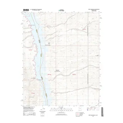
2014 Map of Spirit Mountain SE
USGS Topo · Published 2014About this map
Mohave Crossing serves as a central point on this 2014 survey along the state line of the Nevada Arizona border. The landscape is defined by the broad expanse of Lake Mohave, which submerges much of the river valley and isolates Cottonwood Island near the northern map edge. The terrain east of the water is characterized by a network of drainage systems, including Empire Wash, Lost Cabin Wash, and the notably named Gasoline Alley.
Find a feature on this map
26 named features on this map. Tap any name to fly to it.
Don’t see what you’re looking for? This feature index may not catch every label — zoom into the map to look around manually.
Map Details
Editions of this 2014 Spirit Mountain SE Map
This is the sole edition of this map. No revisions or reprints were ever made.
Other maps of this area

1886 · Camp Mohave
USGS Topo · 1:250,000

1892 · Camp Mohave
USGS Topo · 1:250,000

1926 · Mohave City
USGS Topo · 1:96,000

1942 · Camp Mohave
USGS Topo · 1:250,000

1947 · Kingman
USGS Topo · 1:250,000

1948 · Kingman
USGS Topo · 1:250,000

1950 · Davis Dam
USGS Topo · 1:62,500

1952 · Davis Dam
USGS Topo · 1:62,500

1954 · Kingman
USGS Topo · 1:250,000

1955 · Kingman
USGS Topo · 1:250,000