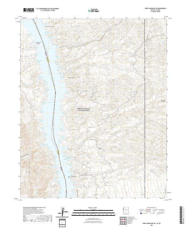
2021 Map of Spirit Mountain SE
USGS Topo · Published 2021About this map
Lake Mohave dominates the central corridor of this desert landscape, following the border between Arizona and Nevada. The reservoir is lined with numerous named coves that trace the submerged topography of the Cottonwood Valley, including Eighty-Three Dollar Cove and Portland Gold Cove. These names suggest a history of prospecting and river travel that preceded the damming of the Colorado River. To the east, the terrain rises into the Mojave Desert plateaus, dissected by drainage systems like Granite Wash and Tyro Wash. The western shore is framed by the Newberry Mountains, where Cottonwood Island remains a prominent feature within the waterway. Near the southern edge of the sheet, local access points like Princess Cove Rd and the cheekily named Gasoline Alley provide modern context to this vast recreation area.
Find a feature on this map
70 named features on this map. Tap any name to fly to it.
Don’t see what you’re looking for? This feature index may not catch every label — zoom into the map to look around manually.
Map Details
Editions of this 2021 Spirit Mountain SE Map
This is the sole edition of this map. No revisions or reprints were ever made.
Other maps of this area

1886 · Camp Mohave
USGS Topo · 1:250,000

1892 · Camp Mohave
USGS Topo · 1:250,000

1926 · Mohave City
USGS Topo · 1:96,000

1942 · Camp Mohave
USGS Topo · 1:250,000

1947 · Kingman
USGS Topo · 1:250,000

1948 · Kingman
USGS Topo · 1:250,000

1950 · Davis Dam
USGS Topo · 1:62,500

1952 · Davis Dam
USGS Topo · 1:62,500

1954 · Kingman
USGS Topo · 1:250,000

1955 · Kingman
USGS Topo · 1:250,000