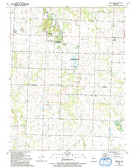
1991 Map of Sprague
USGS Topo · Published 1991About this map
The settlement of Sprague serves as a central landmark in this southwestern Missouri landscape, situated near the boundary where Howard and New Home townships meet. The terrain is defined by the winding paths of Muddy Creek and Pryor Creek, with the latter joined by the Rutledge Fork Pryor Creek. Significant portions of the land are dedicated to conservation, including the Peabody State Wildlife Area and the Harmony Mission State Wildlife Area, which features a Boat Ramp for local access.
Find a feature on this map
23 named features on this map. Tap any name to fly to it.
Don’t see what you’re looking for? This feature index may not catch every label — zoom into the map to look around manually.
Map Details
Editions of this 1991 Sprague Map
This is the sole edition of this map. No revisions or reprints were ever made.
Other maps of this area

1884 · Fort Scott
USGS Topo · 1:125,000

1886 · Nevada
USGS Topo · 1:125,000

1886 · Fort Scott
USGS Topo · 1:125,000

1887 · Butler
USGS Topo · 1:125,000

1887 · Mound City
USGS Topo · 1:125,000

1893 · Fort Scott
USGS Topo · 1:125,000

1893 · Mound City
USGS Topo · 1:125,000

1894 · Butler
USGS Topo · 1:125,000

1894 · Nevada
USGS Topo · 1:125,000

1936 · Rich Hill
USGS Topo · 1:24,000