Loading...
Loading map...2024 Map of Spring Valley
USGS Topo · Published 2024About this map
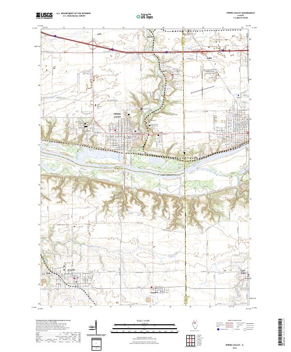
The Illinois River corridor anchors this region of Illinois, where the cities of Spring Valley and Peru sit atop the northern bluffs overlooking the river valley. The landscape is deeply tied to the heritage of the many surrounding communities, including Ladd, Dalzell, and Granville. The area's cultural history is documented through its numerous spiritual and burial grounds, such as the Lithuanian Cem, Saint Bede Cem, and Saint Valentines Cem.
Find a feature on this map
113 named features on this map. Tap any name to fly to it.
Don’t see what you’re looking for? This feature index may not catch every label — zoom into the map to look around manually.
Map Details
Date Portrayed2024
Date Published2024
PublisherU.S. Geological Survey
Map TypeTopographic
Scale1:24000
Physical Dimensions24 x 29 inches
Editions of this 2024 Spring Valley Map
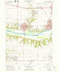
This is the sole edition of this map. No revisions or reprints were ever made.
Historical Maps of Mark Through Time
Featured Locations
Source Details
SourceU.S. Geological Survey
CopyrightPublic Domain