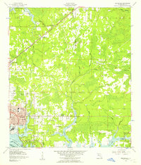
1956 Map of Springfield
USGS Topo · Published 1957About this map
The growing communities of Springfield and Parker anchor this mid-century survey of the Florida panhandle coastline. Heavily influenced by the presence of Tyndall Air Force Base along the St Andrew Bay, the landscape exhibits a mix of residential expansion and industrial activity. The Atlanta and St Andrews Bay railroad line serves as a central spine through the region, connecting the coastal settlements to inland points like College Station and Brannonville.
Find a feature on this map
44 named features on this map. Tap any name to fly to it.
Don’t see what you’re looking for? This feature index may not catch every label — zoom into the map to look around manually.
Map Details
Editions of this 1956 Springfield Map
This is the sole edition of this map. No revisions or reprints were ever made.
Other maps of this area

1943 · Beacon Beach
USGS Topo · 1:31,680

1943 · Panama City
USGS Topo · 1:31,680

1943 · Southport
USGS Topo · 1:24,000

1944 · Southport
USGS Topo · 1:24,000

1944 · Long Point
USGS Topo · 1:31,680

1944 · Bayhead
USGS Topo · 1:24,000

1945 · Youngstown
USGS Topo · 1:31,680

1945 · Bayhead
USGS Topo · 1:31,680

1945 · Allanton
USGS Topo · 1:31,680

1945 · North Of Allanton
USGS Topo · 1:31,680