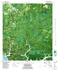
1982 Map of Springfield
USGS Topo · Published 1983About this map
St Andrew Bay and the winding Intracostal Waterway define the coastal character of this early 1980s orthophotomap. The expansion of Springfield and Callaway is evident through the dense grid of residential streets encroaching upon the wet pine flatwoods and cypress strands. Local civic life is anchored by institutions like Rutherford High School and several community churches including Midway Church and the Howard Carlisle Church. Along the bayous and creeks, the transition from urbanized areas to natural wetlands is sharp, with numerous named water bodies like Callaway Bayou and Laird Bayou framing the landscape. The industrial presence of the Atlanta and St Andrews Bay RR and the Water Treatment Plant reflects the infrastructure supporting this growing Gulf Coast corridor.
Find a feature on this map
56 named features on this map. Tap any name to fly to it.
Don’t see what you’re looking for? This feature index may not catch every label — zoom into the map to look around manually.
Map Details
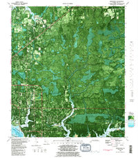
Editions of this 1982 Springfield Map
2 editions found
Other maps of this area

1943 · Beacon Beach
USGS Topo · 1:31,680

1943 · Panama City
USGS Topo · 1:31,680

1943 · Southport
USGS Topo · 1:24,000

1944 · Southport
USGS Topo · 1:24,000

1944 · Long Point
USGS Topo · 1:31,680

1944 · Bayhead
USGS Topo · 1:24,000

1945 · Youngstown
USGS Topo · 1:31,680

1945 · Bayhead
USGS Topo · 1:31,680

1945 · Allanton
USGS Topo · 1:31,680

1945 · North Of Allanton
USGS Topo · 1:31,680