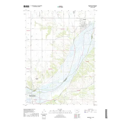
2017 Map of Springfield
USGS Topo · Published 2017About this map
The Missouri River forms a wide, braided corridor at the border of South Dakota and Nebraska, dominating the landscape south of Springfield. This 2017 survey details the transition from the upland plateau down to the river bottoms, where the Missouri National Recreation River protects the free-flowing character of the water before it reaches Lewis and Clark Lake. The town of Springfield is mapped in detail, showing its grid of streets such as Elm St and Walnut St, along with the Springfield Cem and Saint Vincents Cem to the north. To the west, the small settlement of Running Water sits near the riverbanks. The mapping of Maidens Leap and the confluence of Bazile Creek provides insight into the local topography, while the network of section-line roads like 312th St illustrates the enduring rural infrastructure of Bon Homme County.
Find a feature on this map
57 named features on this map. Tap any name to fly to it.
Don’t see what you’re looking for? This feature index may not catch every label — zoom into the map to look around manually.
Map Details
Editions of this 2017 Springfield Map
This is the sole edition of this map. No revisions or reprints were ever made.
Other maps of this area

1950 · Niobrara
USGS Topo · 1:24,000

1950 · Verdigre NE
USGS Topo · 1:24,000

1955 · Sioux City
USGS Topo · 1:250,000

1955 · O'Neill
USGS Topo · 1:250,000

1958 · Sioux City
USGS Topo · 1:250,000

1959 · O'Neill
USGS Topo · 1:250,000

1959 · Sioux City
USGS Topo · 1:250,000

1969 · O'Neill
USGS Topo · 1:250,000

1974 · Sparta
USGS Topo · 1:24,000

1974 · Howe Creek
USGS Topo · 1:24,000
Featured Places
- Springfield, SD
- Running Water Township, SD
- Hancock Township, SD
- Springfield Township, SD
- Running Water, SD