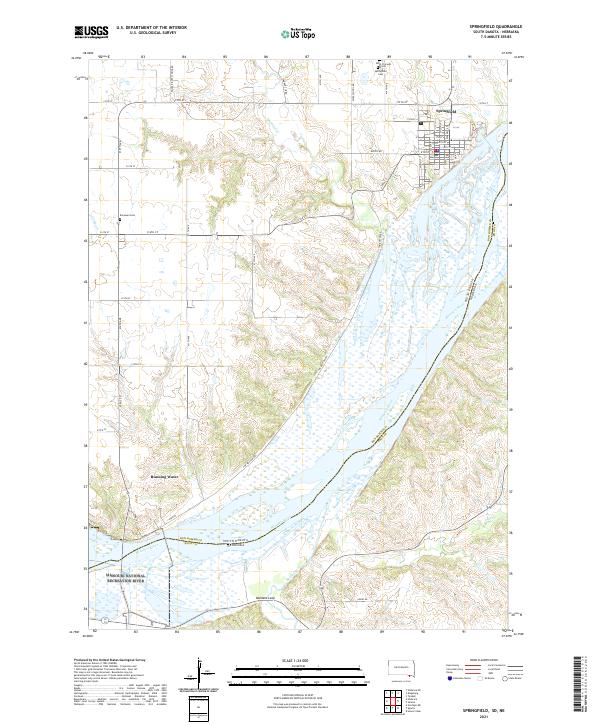
2021 Map of Springfield
USGS Topo · Published 2021About this map
The Missouri River forms a wide, braided corridor through this region, marking the boundary between Bon Homme County and Knox County and the state line of South Dakota and Nebraska. The settlement of Springfield is situated on the northern bluffs, characterized by a structured grid of streets including Walnut St and Cedar St, and serves as a local anchor near the Springfield Cem and Saint Vincents Cem. Further downstream, the small community of Running Water sits at a narrow point in the river valley, reflecting a long history of river-based transport and settlement patterns.
Find a feature on this map
54 named features on this map. Tap any name to fly to it.
Don’t see what you’re looking for? This feature index may not catch every label — zoom into the map to look around manually.
Map Details
Editions of this 2021 Springfield Map
This is the sole edition of this map. No revisions or reprints were ever made.
Other maps of this area

1950 · Niobrara
USGS Topo · 1:24,000

1950 · Verdigre NE
USGS Topo · 1:24,000

1955 · Sioux City
USGS Topo · 1:250,000

1955 · O'Neill
USGS Topo · 1:250,000

1958 · Sioux City
USGS Topo · 1:250,000

1959 · O'Neill
USGS Topo · 1:250,000

1959 · Sioux City
USGS Topo · 1:250,000

1969 · O'Neill
USGS Topo · 1:250,000

1974 · Sparta
USGS Topo · 1:24,000

1974 · Howe Creek
USGS Topo · 1:24,000
Featured Places
- Springfield, SD
- Running Water Township, SD
- Hancock Township, SD
- Running Water, SD
- Springfield Township, SD