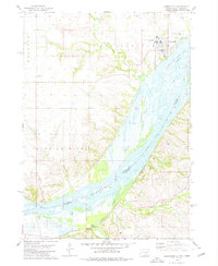
1978 Map of Springfield
USGS Topo · Published 1979About this map
Springfield sits prominently on the northern bluffs of the Missouri River in this late 1970s survey, overlooking the expansive Lewis and Clark Lake on the border of South Dakota and Nebraska. The town is defined by the University of South Dakota at Springfield campus and its local landmarks, including the St Vincents Cem and Springfield Cem. To the east, the Springfield Recreation Area marks the river's edge, while the surrounding landscape is carved by Emanuel Creek and Bazile Creek.
Find a feature on this map
23 named features on this map. Tap any name to fly to it.
Don’t see what you’re looking for? This feature index may not catch every label — zoom into the map to look around manually.
Map Details
Editions of this 1978 Springfield Map
This is the sole edition of this map. No revisions or reprints were ever made.
Other maps of this area

1950 · Niobrara
USGS Topo · 1:24,000

1950 · Verdigre NE
USGS Topo · 1:24,000

1955 · Sioux City
USGS Topo · 1:250,000

1955 · O'Neill
USGS Topo · 1:250,000

1958 · Sioux City
USGS Topo · 1:250,000

1959 · O'Neill
USGS Topo · 1:250,000

1959 · Sioux City
USGS Topo · 1:250,000

1969 · O'Neill
USGS Topo · 1:250,000

1974 · Sparta
USGS Topo · 1:24,000

1974 · Howe Creek
USGS Topo · 1:24,000
Featured Places
- Springfield, SD
- Hancock Township, SD
- Springfield Township, SD
- Running Water, SD
- Running Water Township, SD