2023 Map of Springfield
USGS Topo · Published 2023About this map
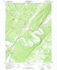
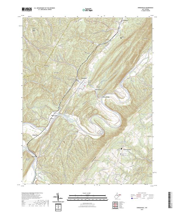
Springfield and its surrounding Hampshire County landscape are defined by the winding course of the South Branch Potomac River, which cuts through the ridge-and-valley terrain of West Virginia. The settlement pattern here follows the river valley and the gaps between prominent elevations like Mill Creek Mountain and South Branch Mountain. Local history and genealogy are well-represented by multiple burial sites, including Springfield Hill Cem and Mount Bethel Cem, as well as the clustered community at Three Churches. Significant industrial and transportation markers include Millesons Mill and the Eastview Airport near the center of the quadrangle. The map also traces a section of the American Discovery Trail, which skirts Donaldson and the Donaldson School in the north. Small settlements like Grace, Blues Beach, and Ritters occupy the narrow land between the river and the steep slopes of Buck Ridge.
Find a feature on this map
117 named features on this map. Tap any name to fly to it.
Don’t see what you’re looking for? This feature index may not catch every label — zoom into the map to look around manually.
Map Details
Editions of this 2023 Springfield Map
This is the sole edition of this map. No revisions or reprints were ever made.