Old Maps of Hampshire County, West Virginia
Explore 173 old maps of Hampshire County, spanning from 1891 to today. These high-resolution historic maps reveal how streets, neighborhoods, landmarks, and natural features evolved over time — perfect for genealogy, metal detecting, research, and local history exploration.
What you can do with these maps:
- See how Hampshire County changed over time: Compare historical maps to modern-day views to trace roads, homesites, rail lines & more.
- View detailed metadata: Each map includes creators, publishers, year, scale, and archive source.
- Overlay maps with satellite & LiDAR: Visualize the past alongside modern tools to explore terrain & human change.
- Trusted historical sources: Maps sourced from the USGS, Library of Congress, and other archives.
- Access maps your way: View online, download high-res files, or order prints for personal or research use.
Start exploring old maps of Hampshire County to uncover forgotten places, hidden landmarks, and the deep history beneath your feet.
Hampshire County, WV maps
(173)- 1891 Map of Romney, 1897 Print
 1891 Romney1897 Print · USGSHampshire, Hardy, and Mineral counties are captured here in the 1880s as the river valleys were transitioning from frontier outposts to connected industrial hubs. Genealogists and historians can trace family locations near Capon Iron Works, Adams Mill, and the many hamlets along Patterson Creek.5 unique versions available
 - 1894 Map of Winchester, 1899 Print
 1894 Winchester1899 Print · USGSThe Virginia and West Virginia borderlands appear here in the late nineteenth century, showing a landscape defined by mountain ridges and bustling rail junctions. Researchers can trace early rural life through family-named sites like Unger Store and Fawcetts Gap or the resort history of Capon Springs.6 unique versions available
 - 1898 Map of Paw Paw, 1982 Print
 1898 Paw Paw1982 Print · USGSThe Potomac River meanders through the Appalachian ridges at the turn of the century, where Maryland, West Virginia, and Pennsylvania meet. Genealogists and historians can trace the early industrial corridor of the Chesapeake and Ohio Canal and find old rail stops like Magnolia and Doe Gully.
 - 1899 Map of Flintstone
 1899 Flintstone1899 Print · USGSThe Maryland, West Virginia, and Pennsylvania borders converge here during the late nineteenth century as industry follows the river. Genealogists can trace family footprints near Oldtown or locate vanished infrastructure like Patterson Depot and the C. & O. Canal.
 - 1900 Map of Pawpaw
 1900 Pawpaw1900 Print · USGSThe Potomac River's intricate meanders define this borderland at the close of the nineteenth century. Researchers can trace the parallel routes of the Chesapeake and Ohio Canal and the Baltimore and Ohio Railroad past Magnolia, Dam No. 6, and Fisher Ford.8 unique versions available
 - 1900 Map of Flintstone
 1900 Flintstone1900 Print · USGSThe Maryland and West Virginia border at the close of the nineteenth century centers on the vital Potomac River transportation corridor. Researchers can trace the Chesapeake and Ohio Canal, the B. & O. R. R., and early settlements like Oldtown, Flintstone, and Wolf Mill.6 unique versions available
 - 1910 Map of Paw Paw, 1959 Print
 1910 Paw Paw1959 Print · USGSMaryland and West Virginia meet along the serpentine Potomac River in the early twentieth century as railroads and canals compete for the valley. Trace the industrial landscape from the Ohio and Chesapeake Canal to the river towns of Paw Paw and Little Orleans.
 - 1916 Map of Capon Bridge
 1916 Capon Bridge1916 Print · USGSThe northern Panhandle and Virginia borderlands are documented here just before the Great War. Genealogists and local historians can locate early educational landmarks like Timber Ridge School and Morton Grove School alongside the rural hub of Ungers Store.2 unique versions available
 - 1920 Map of Moorefield, 1958 Print
 1920 Moorefield1958 Print · USGSHardy and Hampshire Counties come alive in the 1920s as the Baltimore and Ohio RR winds through the Trough. Genealogists can locate family homesteads near dozens of rural landmarks like Old Pine Church, Sector PO, and the Hines School.2 unique versions available
 - 1920 Map of Keyser, 1964 Print
 1920 Keyser1964 Print · USGSMineral and Hampshire counties in the 1920s reveal a landscape of deep river valleys and prominent ridges tied together by the Baltimore and Ohio RR. Researchers can locate dozens of country schools and churches, from Trinity Church to the Pancake School and Reeses Mill.
 - 1921 Map of Keyser
 1921 Keyser1921 Print · USGSThe Potomac River valley and the ridges of Mineral and Hampshire counties are captured here in the early twenties. Researchers can locate vanished landmarks like the Russellville PO, industrial sites at Ochre, and dozens of rural schoolhouses from Red Star School to Knobly School.2 unique versions available
 - 1921 Map of Hanging Rock
 1921 Hanging Rock1921 Print · USGSHampshire County in the early twentieth century is captured here as a landscape of isolated mountain hollows and river settlements. Genealogists can locate dozens of neighborhood landmarks like Milesons Mill, Tearcoat Church, and schools such as Shady Grove School.3 unique versions available
 - 1921 Map of Moorefield
 1921 Moorefield1921 Print · USGSHardy and Hampshire counties come to life in the early 1920s as mountain settlements like Needmore and Oldfields cluster along the river gaps. Researchers can locate dozens of vanished rural schoolhouses and churches, from Thrasher Spring School to Old Pine Church.2 unique versions available
 - 1922 Map of Moorefield
 1922 Moorefield1922 Print · USGSHardy and Hampshire counties come into focus in the early 1920s as the river-and-rail economy defined the Potomac Highlands. Genealogists can trace family names through landmarks like Potter Spring Knob and rural centers such as Old Pine Church and Globe PO.2 unique versions available
 - 1922 Map of Wardensville
 1922 Wardensville1922 Print · USGSThe Hardy County highlands in the early twenties show a landscape of isolated hollows and mountain railroads. Genealogists can locate family homesteads near numerous country schools like Sugar Grove School and tracks of the Winchester and Western.
 - 1922 Map of Keyser
 1922 Keyser1922 Print · USGSThe Potomac borderlands in the early 1920s reveal a landscape of deep valleys and vital rail connections along the West Virginia-Maryland line. Genealogists and local historians can trace rural family life through dozens of named schools like Red Star School and historic landmarks such as Trinity Church and Vanderlip P.O.3 unique versions available
 - 1923 Map of Middletown
 1923 Middletown1923 Print · USGSThe West Virginia and Virginia borderlands were a patchwork of mountain farms and river crossings in the early 1920s. Genealogists can trace family names through landmarks like Hooks Mills, Capon Springs, and the Christian Church.
 - 1923 Map of Capon Bridge
 1923 Capon Bridge1923 Print · USGSHampshire County and the winding river valley come to life in this early-twentieth-century study of the borderlands. Researchers can trace ancestral property and community hubs from Capon Bridge to Island Hill Church and the Pike School.2 unique versions available
 - 1923 Map of Hanging Rock
 1923 Hanging Rock1923 Print · USGSHampshire County at the start of the twenties is captured here as a landscape of ridge-top schools and valley mills. Researchers can trace the Northwestern Turnpike or locate vanished landmarks like Millesons Mill, Three Churches, and the Baltimore and Ohio RR.4 unique versions available
 - 1924 Map of Wardensville
 1924 Wardensville1924 Print · USGSWardensville and the surrounding mountains of Hardy County are shown here during the early twenties. Genealogists can trace family names through landmarks like Heishman School, Rio, and Crest Hill Church along the river valleys.2 unique versions available
 - 1937 Map of Capon Bridge
 1937 Capon Bridge1937 Print · USGSCrossing the border of Virginia and West Virginia in the late 1930s, this area reveals a landscape of ridge-top schools and valley rail lines. Researchers can trace ancestral routes along the Northwestern Turnpike or locate family sites near Mt Hebron Ch and Reynolds Store.4 unique versions available
 - 1937 Map of Middletown
 1937 Middletown1937 Print · USGSFrederick and Shenandoah Counties are surveyed here in the late 1930s, documenting the valley's ridge-and-hollow terrain and Civil War history. Genealogists can locate family landmarks like Nieswanders Fort, Quaker Hill Cem, and the industry at Star Tannery.2 unique versions available
 - 1943 Map of Capon Bridge
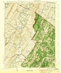 1943 Capon Bridge1943 Print · USGSHampshire and Frederick Counties appear in the early 1940s as a landscape of winding mountain rivers and quiet ridge-top settlements. Researchers can trace historic family landmarks and community hubs like Capon Chapel, the Northwestern Turnpike, and Forks of Cacapon.2 unique versions available
 - 1943 Map of Middletown
 1943 Middletown1943 Print · USGSThe Virginia and West Virginia borderlands are revealed in this wartime-era survey of Frederick County and the surrounding ridges. Genealogists and historians can trace family locations near Star Tannery, the Cedar Creek Battlefield, or old schoolhouses like Mountain View Sch.2 unique versions available
 - 1945 Map of Moorefield
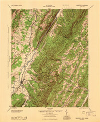 1945 Moorefield1945 Print · USGSHardy and Hampshire counties at the close of World War II reveal a landscape defined by the Potomac river-and-rail economy. Genealogists can locate family landmarks like Reynolds Gap and rural centers such as Old Pine Ch and Bethel Sch.
Showing maps 1-25 of 173
Top cities of Hampshire County
Frequently asked questions
- What are the different types of historical maps available for Hampshire County?
- What is the oldest map of Hampshire County?
- Where can I purchase historical maps of Hampshire County for my home or office?
- Where can I download high-res historical maps of Hampshire County?
- Are there historical topographic maps available for Hampshire County?
- Is there historical aerial imagery available for Hampshire County?
- Where are historical maps of Hampshire County sourced from?