Old Maps of Romney, West Virginia
Explore 25 old maps of Romney, spanning from 1891 to today. These high-resolution historic maps reveal how streets, neighborhoods, landmarks, and natural features evolved over time — perfect for genealogy, metal detecting, research, and local history exploration.
What you can do with these maps:
- See how Romney changed over time: Compare historical maps to modern-day views to trace roads, homesites, rail lines & more.
- View detailed metadata: Each map includes creators, publishers, year, scale, and archive source.
- Overlay maps with satellite & LiDAR: Visualize the past alongside modern tools to explore terrain & human change.
- Trusted historical sources: Maps sourced from the USGS, Library of Congress, and other archives.
- Access maps your way: View online, download high-res files, or order prints for personal or research use.
Start exploring old maps of Romney to uncover forgotten places, hidden landmarks, and the deep history beneath your feet.
Romney, WV maps
(25)- 1891 Map of Romney, 1897 Print
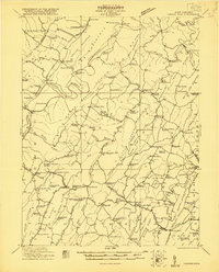
 1891 Romney1897 Print · USGSHampshire, Hardy, and Mineral counties are captured here in the 1880s as the river valleys were transitioning from frontier outposts to connected industrial hubs. Genealogists and historians can trace family locations near Capon Iron Works, Adams Mill, and the many hamlets along Patterson Creek.5 unique versions available
 - 1920 Map of Keyser, 1964 Print
 1920 Keyser1964 Print · USGSMineral and Hampshire counties in the 1920s reveal a landscape of deep river valleys and prominent ridges tied together by the Baltimore and Ohio RR. Researchers can locate dozens of country schools and churches, from Trinity Church to the Pancake School and Reeses Mill.
 - 1921 Map of Keyser
 1921 Keyser1921 Print · USGSThe Potomac River valley and the ridges of Mineral and Hampshire counties are captured here in the early twenties. Researchers can locate vanished landmarks like the Russellville PO, industrial sites at Ochre, and dozens of rural schoolhouses from Red Star School to Knobly School.2 unique versions available
 - 1921 Map of Hanging Rock
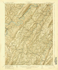
 1921 Hanging Rock1921 Print · USGSHampshire County in the early twentieth century is captured here as a landscape of isolated mountain hollows and river settlements. Genealogists can locate dozens of neighborhood landmarks like Milesons Mill, Tearcoat Church, and schools such as Shady Grove School.3 unique versions available
 - 1922 Map of Keyser
 1922 Keyser1922 Print · USGSThe Potomac borderlands in the early 1920s reveal a landscape of deep valleys and vital rail connections along the West Virginia-Maryland line. Genealogists and local historians can trace rural family life through dozens of named schools like Red Star School and historic landmarks such as Trinity Church and Vanderlip P.O.3 unique versions available
 - 1923 Map of Hanging Rock
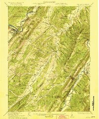
 1923 Hanging Rock1923 Print · USGSHampshire County at the start of the twenties is captured here as a landscape of ridge-top schools and valley mills. Researchers can trace the Northwestern Turnpike or locate vanished landmarks like Millesons Mill, Three Churches, and the Baltimore and Ohio RR.4 unique versions available
 - 1948 Map of Cumberland
 1948 Cumberland1948 Print · USGSMid-century Appalachia and the Shenandoah Valley are shown in detail, documenting the industrial and transportation hubs of the tri-state area. Genealogists can trace family roots through settlements like Double Tollgate and Bunker Hill or along the Baltimore & Ohio RR.3 unique versions available
 - 1952 Map of Cumberland
 1952 Cumberland1952 Print · USGSThe Potomac Highlands and the Shenandoah Valley are revealed in this early 1950s survey of the Appalachian interior. Researchers can trace the river-and-rail corridors connecting Cumberland, Winchester, and the recreational waters of Deep Creek Lake.
 - 1956 Map of Cumberland, 1966 Print
 1956 Cumberland1966 Print · USGSThe tri-state Highlands in the mid-1950s show a landscape shaped by coal, timber, and the massive presence of the Baltimore & Ohio RR. Researchers can trace the industrial corridor from Cumberland through the Allegheny Mountains to mountain retreats like Deep Creek Lake.6 unique versions available
 - 1957 Map of Cumberland
 1957 Cumberland1957 Print · USGSThe Potomac River valley and the ridges of the Allegheny Front define this mid-century landscape at the intersection of Maryland, West Virginia, and Pennsylvania. Trace the steam-era rail lines of the Baltimore and Ohio RR or locate rural landmarks like St Stephens Church and Stony River Dam.
 - 1961 Map of Cumberland
 1961 Cumberland1961 Print · USGSThe tri-state highlands of Maryland, West Virginia, and Pennsylvania are shown in the mid-twentieth century as a complex landscape of ridges and river valleys. Researchers can trace the winding Potomac River and find old rail-and-river towns like Cumberland, Keyser, and Morgantown.
 - 1962 Map of Cumberland
 1962 Cumberland1962 Print · USGSThe central Appalachians meet at the height of the mid-century industrial era, showing the rugged topography between Morgantown and Winchester. Genealogists can trace family lands near Fort Necessity or along the vital Baltimore & Ohio RR corridors.
 - 1973 Map of Augusta, 1975 Print
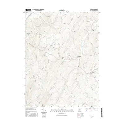
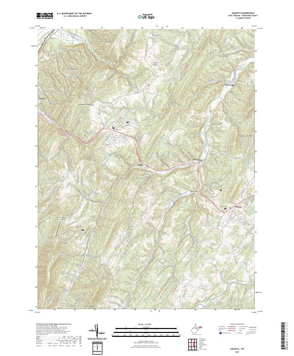
 1973 Augusta1975 Print · USGSHampshire County’s high ridges and river valleys are captured here in the early seventies, showing a rural landscape shaped by the Cacapon River and Stony Mountain. Genealogists and historians can trace family locations near Augusta, Barnes Mill, and several community landmarks like Ebenezer Ch.2 unique versions available
 - 1973 Map of Romney, 1975 Print
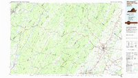
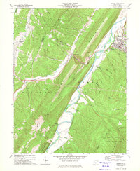 1973 Romney1975 Print · USGSHampshire and Mineral counties in the 1970s show a landscape of sharp ridges and deep river valleys during a period of steady rural development. Genealogists and historians can trace rail-side hamlets like Pancake and Mechanicsburg or locate rural landmarks such as Beaver Run Ch and Trinity Ch.2 unique versions available
 - 1983 Map of Winchester, 1985 Print
 1983 Winchester1985 Print · USGSThe northern Shenandoah Valley and the rugged West Virginia borderlands are captured here in the early eighties. Researchers can trace the rail networks of the B & O RR and find local landmarks like Potomac State College, Three Churches, and the Old Iron Furnace.3 unique versions available
 - 2011 Map of Augusta, 2011 Print
 2011 Augusta2011 Print · USGSCovers Romney, including Frenchburg, Shanks, and other nearby areas
 - 2011 Map of Romney, 2011 Print
 2011 Romney2011 Print · USGSCovers Romney, including Junction, Mechanicsburg, and other nearby areas
 - 2014 Map of Augusta, 2014 Print
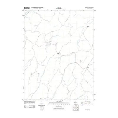
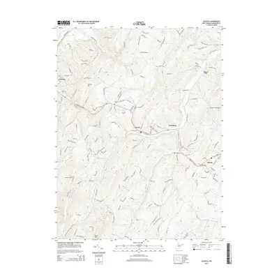 2014 Augusta2014 Print · USGSCovers Romney, including Frenchburg, Shanks, and other nearby areas
 - 2014 Map of Romney, 2014 Print
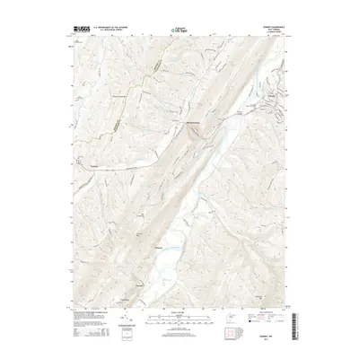 2014 Romney2014 Print · USGSCovers Romney, including Junction, Mechanicsburg, and other nearby areas
 - 2016 Map of Romney, 2016 Print
 2016 Romney2016 Print · USGSCovers Romney, including Junction, Mechanicsburg, and other nearby areas
 - 2016 Map of Augusta, 2016 Print
 2016 Augusta2016 Print · USGSCovers Romney, including Frenchburg, Shanks, and other nearby areas
 - 2019 Map of Romney, 2019 Print
 2019 Romney2019 Print · USGSCovers Romney, including Junction, Mechanicsburg, and other nearby areas
 - 2019 Map of Augusta, 2019 Print
 2019 Augusta2019 Print · USGSCovers Romney, including Frenchburg, Shanks, and other nearby areas
 - 2023 Map of Romney, 2023 Print
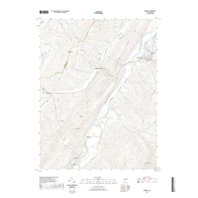
 2023 Romney2023 Print · USGSHampshire County and the South Branch Potomac River are captured here in the early 2020s, showing the intersection of mountain geography and deep-rooted settlements. Researchers can locate family landmarks like Indian Mound Cem, Whip Cem, and the historic judicial center in Romney.
 - 2023 Map of Augusta, 2023 Print
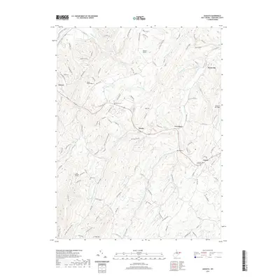
 2023 Augusta2023 Print · USGSHampshire County ridge-and-valley terrain comes into focus in this contemporary survey of the settlements along the US-50 corridor. Researchers can trace family roots through sites like the Augusta Cemetery, Old Bethel Church, and the former milling site at Barnes Mill.
End of results
Showing maps 1-25 of 25
Top cities near Romney
- Keyser historical maps
- Lonaconing historical maps
- Rawlings historical maps
- McCoole historical maps
- Bier historical maps
Top neighborhoods of Romney
- Valley historical maps
- Romney Junction historical maps
- Homewood Addition historical maps
- Loy-Long Addition historical maps
Frequently asked questions
- What are the different types of historical maps available for Romney?
- What is the oldest map of Romney?
- Where can I purchase historical maps of Romney for my home or office?
- Where can I download high-res historical maps of Romney?
- Are there historical topographic maps available for Romney?
- Is there historical aerial imagery available for Romney?
- Where are historical maps of Romney sourced from?