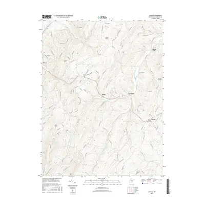
2016 Map of Augusta
USGS Topo · Published 2016About this map
Augusta and Shanks sit within a landscape defined by the branching tributaries of the Little Cacapon River in this modern Hampshire County survey. The terrain is marked by prominent elevations like S Branch Mtn and Stony Mtn, creating deep valleys such as Trinton Hollow and Bell Hollow. Settlement patterns follow the winding paths of county routes and rural drives, with significant local history anchored by Ebenezer Cem, Bethel Cem, and the Methodist Church Cem near the town center. The presence of Barnes Mill on the river's edge suggests a legacy of water-powered industry, while the Lost Mountain Airport represents more recent logistical infrastructure. Rare features like the Everett Fruit Farm Spring indicate the area's agricultural heritage, specifically its ties to the region's orchard economy, while landmarks like Quiveys Lookout and Chestnut Oak Ridge provide specific topographical reference points for genealogists tracing family land tracts.
Find a feature on this map
125 named features on this map. Tap any name to fly to it.
Don’t see what you’re looking for? This feature index may not catch every label — zoom into the map to look around manually.
Map Details
Editions of this 2016 Augusta Map
This is the sole edition of this map. No revisions or reprints were ever made.
Other maps of this area

1891 · Romney
USGS Topo · 1:125,000

1920 · Moorefield
USGS Topo · 1:62,500

1920 · Keyser
USGS Topo · 1:62,500

1921 · Keyser
USGS Topo · 1:48,000

1921 · Hanging Rock
USGS Topo · 1:48,000

1921 · Moorefield
USGS Topo · 1:48,000

1922 · Moorefield
USGS Topo · 1:62,500

1922 · Wardensville
USGS Topo · 1:62,500

1922 · Keyser
USGS Topo · 1:62,500

1923 · Hanging Rock
USGS Topo · 1:62,500