
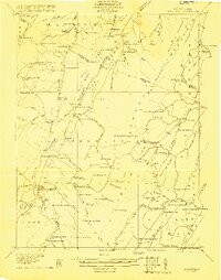
1921 Map of Moorefield
USGS Topo · Published 1921About this map
Moorefield serves as the valley anchor for this area of Hardy and Hampshire counties, where the South Branch Potomac River winds between the steep ridges of Mill Creek Mountain and Moorefield Mountain. The 1921 landscape is dense with small rural institutions that tell the story of early Appalachian settlement. Numerous family-named schoolhouses such as McNeill School and Hines School dot the hollows, while a Logging RR near Anderson Run points to the timber industry's reach into the western slopes.
Find a feature on this map
97 named features on this map. Tap any name to fly to it.
Don’t see what you’re looking for? This feature index may not catch every label — zoom into the map to look around manually.
Map Details
Editions of this 1921 Moorefield Map
2 editions found
Other maps of this area

1891 · Romney
USGS Topo · 1:125,000

1892 · Franklin
USGS Topo · 1:125,000

1892 · Woodstock
USGS Topo · 1:125,000

1895 · Piedmont
USGS Topo · 1:125,000

1896 · Franklin
USGS Topo · 1:125,000

1919 · Elk Garden
USGS Topo · 1:48,000

1920 · Elk Garden
USGS Topo · 1:48,000

1920 · Petersburg
USGS Topo · 1:48,000

1920 · Moorefield
USGS Topo · 1:62,500

1920 · Keyser
USGS Topo · 1:62,500