1990s Maps of Hampshire County, West Virginia
Explore 5 historic maps of Hampshire County from the 1990s. These maps offer a rare glimpse into what life looked like during the 1990s — showing old roads, neighborhoods, homes, and landmarks that have changed or disappeared over time.
Whether you're researching your family's past, planning a metal detecting trip, or studying how Hampshire County's landscape evolved across the 1990s, these high-resolution maps are a powerful tool for exploring the history of this region.
- Focus on a specific era: All maps on this page are from the 1990s, giving you a focused view of this time period.
- See what’s changed: Compare century-old streets, trails, and buildings to today's modern landscape using overlays and satellite layers.
- Research with precision: Use these maps for genealogy, historical research, land use analysis, or educational projects.
- View, download, or print: Maps are fully viewable online in high resolution, and can be downloaded or printed for your own records.
Start exploring Hampshire County's history through authentic maps from the 1990s. This is your window into the past.
Hampshire County, WV maps
(5)- 1996 Map of Patterson Creek, 2001 Print
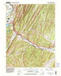 1996 Patterson Creek2001 Print · USGSThe West Virginia-Maryland borderland appears in the mid-1990s as a landscape of sharp ridges and river valleys. Researchers can trace the legacy of transport history along the North Branch Potomac River and find family sites at Mt Tabor Cem and Patterson Creek.
 - 1996 Map of Paw Paw, 2001 Print
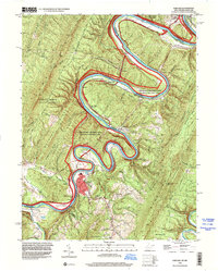 1996 Paw Paw2001 Print · USGSThe Potomac River meanders through the mountainous West Virginia and Maryland borderlands in the mid-1990s. Genealogists and historians can trace the paths of the C & O Canal and locate rural landmarks like Sulphur Springs Ch and the Milo School.
 - 1998 Map of Oldtown, 1999 Print
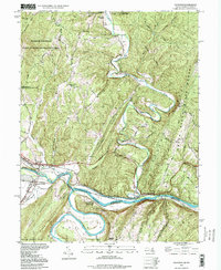 1998 Oldtown1999 Print · USGSMaryland and West Virginia meet along the winding Potomac in the late 1990s, where rail and canal history intersect. Trace the legacy of the B & O Railroad through Oldtown and Okonoko, or find family landmarks like the Mount Olive Church.
 - 1999 Map of Baker, 2001 Print
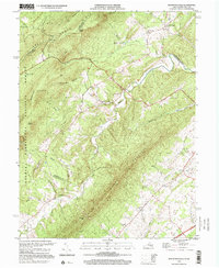
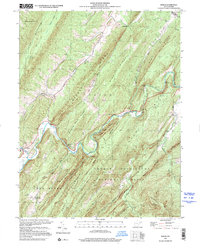 1999 Baker2001 Print · USGSHardy County's steep ridges and river valleys are captured here as they appeared at the turn of the millennium. Researchers can trace historic family locations at Baughman Settlement, visit the Old Iron Furnace, and locate the Baker Sch and Mt Moriah Ch.
 - 1999 Map of Mountain Falls, 2001 Print
 1999 Mountain Falls2001 Print · USGSThe Virginia-West Virginia borderlands at the close of the twentieth century show a landscape of deep hollows and persistent rural settlements. Genealogists can locate family landmarks like Gravel Springs Cem, Star Tannery, and St Stephens Ch along the base of North Mountain.
End of results
Showing maps 1-5 of 5
Top cities of Hampshire County
Frequently asked questions
- What are the different types of historical maps available for Hampshire County?
- What is the oldest map of Hampshire County?
- Where can I purchase historical maps of Hampshire County for my home or office?
- Where can I download high-res historical maps of Hampshire County?
- Are there historical topographic maps available for Hampshire County?
- Is there historical aerial imagery available for Hampshire County?
- Where are historical maps of Hampshire County sourced from?