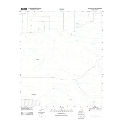
2011 Map of Squaretop Hills East
USGS Topo · Published 2011About this map
Gears Ranch and Whitehead Ranch anchor a landscape defined by ranching life in the foothills of the Squaretop Hills. This 2011 survey illustrates the rural infrastructure of Cochise County, where isolated homesteads like the Moore Ranch are connected by a web of desert roads including E Rucker Canyon Rd and the S Kuykendall Cutoff Rd. The topography rises sharply into the Swisshelm Mountains in the south, while the northern drainage is carved by Ash Creek and Pridham Creek. The inclusion of the Ash Creek Airport alongside traditional features like Brushy Tank highlights the persistence of large-scale land holdings in this arid region, providing a detailed look at modern land use and historical property boundaries in southeastern Arizona.
Find a feature on this map
31 named features on this map. Tap any name to fly to it.
Don’t see what you’re looking for? This feature index may not catch every label — zoom into the map to look around manually.
Map Details
Editions of this 2011 Squaretop Hills East Map
This is the sole edition of this map. No revisions or reprints were ever made.
Other maps of this area

1916 · Pearce
USGS Topo · 1:125,000

1917 · Chiricahua
USGS Topo · 1:125,000

1919 · Chiricahua
USGS Topo · 1:125,000

1922 · Swisshelm
USGS Topo · 1:62,500

1926 · Light
USGS Topo · 1:62,500

1926 · Rucker
USGS Topo · 1:62,500

1926 · Pedregosa
USGS Topo · 1:62,500

1955 · Douglas
USGS Topo · 1:250,000

1958 · Chiricahua Peak
USGS Topo · 1:62,500

1958 · Squaretop Hills
USGS Topo · 1:62,500