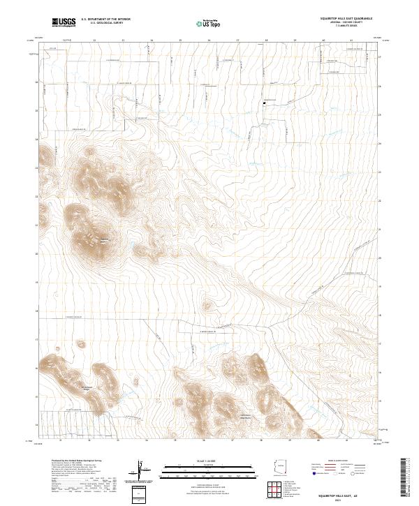
2021 Map of Squaretop Hills East
USGS Topo · Published 2021About this map
Squaretop Hills and the northern reaches of the Swisshelm Mountains dominate this arid landscape in southeastern Arizona. The topography is defined by the significant drainage of Whitewater Draw, which trends southeast toward the border. Settled interest is concentrated along the northern portion of the map, where a dense grid of residential roads like E Camino Verde Dr and E Papago St reveals contemporary subdivision patterns. The lone historic marker, Kambitsch Cem, sits near the banks of Ash Cr, providing a primary point of interest for genealogists and local historians. To the west, the distinctive Whitehead Ridge rises sharply from the basin floor, while ephemeral watercourses such as Stanford Cr and Pridham Cr trace the natural descent from the higher elevations of the Swisshelm range toward the valley below.
Find a feature on this map
50 named features on this map. Tap any name to fly to it.
Don’t see what you’re looking for? This feature index may not catch every label — zoom into the map to look around manually.
Map Details
Editions of this 2021 Squaretop Hills East Map
This is the sole edition of this map. No revisions or reprints were ever made.
Other maps of this area

1916 · Pearce
USGS Topo · 1:125,000

1917 · Chiricahua
USGS Topo · 1:125,000

1919 · Chiricahua
USGS Topo · 1:125,000

1922 · Swisshelm
USGS Topo · 1:62,500

1926 · Light
USGS Topo · 1:62,500

1926 · Rucker
USGS Topo · 1:62,500

1926 · Pedregosa
USGS Topo · 1:62,500

1955 · Douglas
USGS Topo · 1:250,000

1958 · Chiricahua Peak
USGS Topo · 1:62,500

1958 · Squaretop Hills
USGS Topo · 1:62,500