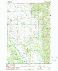
1988 Map of Squaw Creek
USGS Topo · Published 1989About this map
The Madison River corridor and its western tributaries define this high-altitude landscape within the Beaverhead National Forest. This 1980s-era study captures the intersection of forestry operations and wilderness conservation, prominently featuring the Lee Metcalf Wilderness boundary. Local land use is characterized by a mix of recreation and administrative management, seen at the Lyon FS Station, Madison Campground, and the West Fork Campground. The terrain is deeply incised by the Squaw Creek system, including its North, Middle, and South forks, which feed into the main river channel. Evidence of high-country ranching and transit remains visible through features like the West Fork Cow Camp, while Standard Creek Road and Bogus Road provide the primary access through this remote portion of Madison County.
Find a feature on this map
26 named features on this map. Tap any name to fly to it.
Don’t see what you’re looking for? This feature index may not catch every label — zoom into the map to look around manually.
Map Details
Editions of this 1988 Squaw Creek Map
This is the sole edition of this map. No revisions or reprints were ever made.
Other maps of this area

1888 · Three Forks
USGS Topo · 1:250,000

1894 · Three Forks
USGS Topo · 1:250,000

1895 · Three Forks
USGS Topo · 1:250,000

1947 · Bozeman
USGS Topo · 1:250,000

1948 · Bozeman
USGS Topo · 1:250,000

1950 · Cliff Lake
USGS Topo · 1:62,500

1950 · Hebgen Dam
USGS Topo · 1:62,500

1950 · Cameron
USGS Topo · 1:62,500

1950 · Sphinx Mountain
USGS Topo · 1:62,500

1955 · Bozeman
USGS Topo · 1:250,000