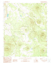
1989 Map of Squaw Mountain
USGS Topo · Published 1990About this map
Kaibab National Forest dominates this northern Arizona landscape, defined by high-elevation terrain and a critical network of water catchments. The area is anchored by the prominent peaks of Squaw Mountain and Cedar Mountain, while the western edge is marked by the broad expanse of Howard Mesa. This topography reveals an environment where seasonal water is essential, evidenced by the numerous named catchments like Geronimo Tank, Laws Natural Tank, and Cowboy Tank.
Find a feature on this map
34 named features on this map. Tap any name to fly to it.
Don’t see what you’re looking for? This feature index may not catch every label — zoom into the map to look around manually.
Map Details
Editions of this 1989 Squaw Mountain Map
This is the sole edition of this map. No revisions or reprints were ever made.
Other maps of this area

1886 · San Francisco Mtns
USGS Topo · 1:250,000

1886 · Chino
USGS Topo · 1:250,000

1891 · San Francisco Mtns
USGS Topo · 1:250,000

1891 · Chino
USGS Topo · 1:250,000

1894 · San Francisco Mtns
USGS Topo · 1:250,000

1899 · San Francisco Mtns
USGS Topo · 1:250,000

1908 · Flagstaff
USGS Topo · 1:125,000

1912 · Flagstaff
USGS Topo · 1:125,000

1922 · Williams
USGS Topo · 1:125,000

1947 · Flagstaff
USGS Topo · 1:250,000