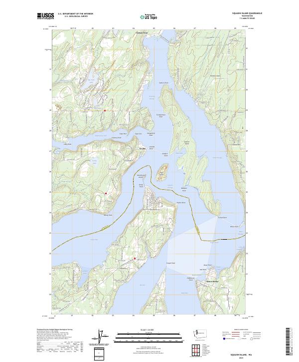
2023 Map of Squaxin Island
USGS Topo · Published 2023About this map
Squaxin Island and the surrounding southern reaches of the South Puget Sound dominate this landscape, where intricate waterways carve through the glacial terrain of Mason and Thurston Counties. The map reveals the complex maritime geography of Pickering Passage and Peale Passage, isolating the central island from the mainland and the larger Harstine Island to the east. The small settlement at Arcadia sits at a strategic point where Hammersley Inlet meets the open sound, reflecting a historical reliance on these protected inlets for transport and local commerce.
Find a feature on this map
142 named features on this map. Tap any name to fly to it.
Don’t see what you’re looking for? This feature index may not catch every label — zoom into the map to look around manually.
Map Details
Editions of this 2023 Squaxin Island Map
This is the sole edition of this map. No revisions or reprints were ever made.
Other maps of this area

1937 · Olympia
USGS Topo · 1:62,500

1938 · Allyn
USGS Topo · 1:62,500

1939 · Shelton
USGS Topo · 1:62,500

1943 · Potlatch
USGS Topo · 1:62,500

1949 · Olympia
USGS Topo · 1:62,500

1952 · Potlatch
USGS Topo · 1:62,500

1953 · Vaughn
USGS Topo · 1:24,000
1953 · Mason Lake
USGS Topo · 1:24,000

1953 · Shelton
USGS Topo · 1:62,500

1958 · Seattle
USGS Topo · 1:250,000