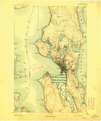
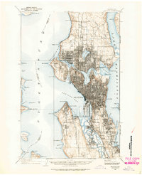
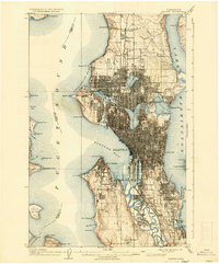
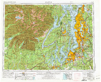
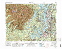
1958 Map of Seattle
USGS Topo · Published 1966About this map
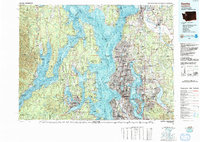
The metropolitan expansion of Seattle and Tacoma is recorded here just as the post-war suburban boom was reshaping the Puget Sound lowlands. While the urban centers along Lake Washington and Puget Sound show dense development, the western half of the sheet remains dominated by the wilderness of Olympic National Park, crowned by Mount Olympus. This contrast highlights the region's mid-century character, balancing heavy industrial and naval footprints at Puget Sound Naval Shipyard and Fort Lewis Military Reservation with the expansive Olympic National Forest. The map also captures the intricate maritime geography of the southern Sound, from Henderson Inlet to The Narrows, where water transport and timber interests shaped early settlements like Shelton and Olympia. Transport networks including the Northern Pacific and Union Pacific railroads illustrate the corridor's role as a major Pacific Northwest logistics hub.
Find a feature on this map
182 named features on this map. Tap any name to fly to it.
Don’t see what you’re looking for? This feature index may not catch every label — zoom into the map to look around manually.
Map Details
Editions of this 1958 Seattle Map
3 editions found
Historical Maps of Seattle Through Time
7 maps found