
Loading...
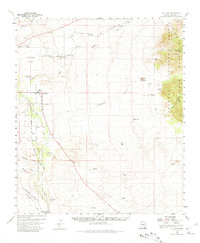
Loading map...1922 Map of St. David
USGS Topo · Published 1928About this map
The San Pedro River corridor serves as the primary artery of development in this 1920s reconnaissance survey, where irrigation and rail infrastructure supported early Cochise County ranching and industry. The settlement of St David and the nearby Apache Powder Co plant signify the area's transition toward industrial manufacturing, while the expansive San Juan de las Boquillas y Nogales land grant reflects the region's Spanish and Mexican heritage.
Find a feature on this map
36 named features on this map. Tap any name to fly to it.
Don’t see what you’re looking for? This feature index may not catch every label — zoom into the map to look around manually.
Map Details
Date Portrayed1922
Date Published1928
PublisherU.S. Geological Survey
Map TypeTopographic
Scale1:62,500
Physical Dimensions17.17 x 22.42 inches
Editions of this 1922 St. David Map
This is the sole edition of this map. No revisions or reprints were ever made.
Historical Maps of Boquillas Through Time
Featured Locations
Source Details
SourceU.S. Geological Survey
CopyrightPublic Domain