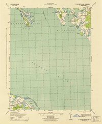
1943 Map of St. George Island
USGS Topo · Published 1943About this map
The St Marys River meets the wide expanse of the Potomac River in this 1943 War Department survey, which highlights the maritime and military significance of this Chesapeake Bay threshold. On the Maryland side, St George Island and St Inigoes serve as critical navigational and tactical points, marked by features such as the St George Navy Mark and various range towers used for maritime calibration. The intricate shorelines of Jutland Neck and Tick Neck are dotted with small landings like Wynne and Potomac View, illustrating the water-dependent economy of St. Mary's County during the war years.
Find a feature on this map
59 named features on this map. Tap any name to fly to it.
Don’t see what you’re looking for? This feature index may not catch every label — zoom into the map to look around manually.
Map Details
Editions of this 1943 St. George Island Map
This is the sole edition of this map. No revisions or reprints were ever made.
Other maps of this area

1892 · Piney Point
USGS Topo · 1:62,500

1894 · Piney Point
USGS Topo · 1:62,500

1894 · Point Lookout
USGS Topo · 1:62,500

1895 · Nomini
USGS Topo · 1:125,000

1895 · Piney Point
USGS Topo · 1:62,500

1898 · Nomini
USGS Topo · 1:125,000

1898 · St. Marys
USGS Topo · 1:125,000

1901 · Piney Point
USGS Topo · 1:62,500

1906 · St. Marys
USGS Topo · 1:125,000

1912 · Point Lookout
USGS Topo · 1:62,500