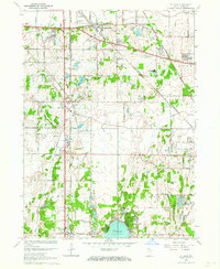
1962 Map of St. John
USGS Topo · Published 1964About this map
Schererville and St John anchor this 1962 topographical survey of northwest Indiana, showing a region undergoing significant suburban transformation. The landscape is a network of mid-century residential developments like Rolling Hill Estates and Lincoln Village, interspersed with institutional landmarks such as Hoosier Boys Town and the St Johns Seminary. A heavy concentration of industrial and transportation infrastructure is evident, with multiple major rail lines including the Erie Lackawanna, Pennsylvania, and New York Central crossing the terrain alongside numerous regional pipelines.
Find a feature on this map
51 named features on this map. Tap any name to fly to it.
Don’t see what you’re looking for? This feature index may not catch every label — zoom into the map to look around manually.
Map Details
Editions of this 1962 St. John Map
2 editions found
Other maps of this area

1892 · Calumet
USGS Topo · 1:62,500

1893 · Calumet
USGS Topo · 1:62,500

1900 · Toleston
USGS Topo · 1:62,500

1900 · Calumet
USGS Topo · 1:62,500

1901 · Calumet
USGS Topo · 1:62,500

1929 · Calumet City
USGS Topo · 1:24,000

1929 · Dyer
USGS Topo · 1:24,000

1930 · Dyer
USGS Topo · 1:24,000

1949 · Crete
USGS Topo · 1:62,500

1953 · Leroy
USGS Topo · 1:24,000