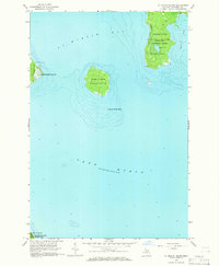
1964 Map of St. Martin Island
USGS Topo · Published 1966About this map
St Martin Bay and the surrounding islands of Lake Huron are the focal points of this mid-1960s survey. The map documents the scattered archipelagic geography of the northern Great Lakes, dominated by the heavily wooded Hiawatha National Forest on the mainland and the prominent St Martin Island. On Big St Martin Island, a notable Indian Burial Ground is identified, indicating the long-standing cultural and historical significance of these landforms before modern recreational and forestry use. The shoreline is characterized by distinctive features such as St Martin Point and the inland Paquin Lake, while the very southern edge of the sheet briefly touches the northernmost reaches of Mackinac Island State Park. This topography captures a landscape defined by water and timber, where only a few unimproved routes like Carpenter Road penetrate the dense forest cover.
Find a feature on this map
14 named features on this map. Tap any name to fly to it.
Don’t see what you’re looking for? This feature index may not catch every label — zoom into the map to look around manually.
Map Details
Editions of this 1964 St. Martin Island Map
2 editions found
Other maps of this area

1931 · St Ignace NW
USGS Topo · 1:31,680

1932 · St Ignace NE
USGS Topo · 1:31,680

1954 · Sault Sainte Marie
USGS Topo · 1:250,000

1955 · Cheboygan
USGS Topo · 1:250,000

1956 · Sault Sainte Marie
USGS Topo · 1:250,000

1957 · Sault Sainte Marie
USGS Topo · 1:250,000

1958 · Cheboygan
USGS Topo · 1:250,000

1958 · Sault Sainte Marie
USGS Topo · 1:250,000

1964 · Round Island
USGS Topo · 1:24,000
1964 · Evergreen Shores
USGS Topo · 1:24,000