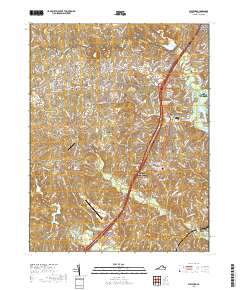
2019 Map of Stafford
USGS Topo · Published 2019About this map
Stafford County Courthouse serves as the civic anchor for this northern Virginia landscape, situated along the heavily traveled corridor where I-95 and Us HWY 1 parallel each other. The map reveals a suburban-rural mix, with established residential areas like Garrisonville and Aquia Harbour contrasting with more open spaces near Moores Corner and Ramoth. Genealogists will find a high density of burial grounds associated with local congregations, including the Aquia Episcopal Church Cem and Mount Ararat Baptist Church Cem.
Find a feature on this map
35 named features on this map. Tap any name to fly to it.
Don’t see what you’re looking for? This feature index may not catch every label — zoom into the map to look around manually.
Map Details
Editions of this 2019 Stafford Map
This is the sole edition of this map. No revisions or reprints were ever made.
Other maps of this area

1887 · Spottsylvania
USGS Topo · 1:125,000

1889 · Fredericksburg
USGS Topo · 1:125,000

1890 · Mt. Vernon
USGS Topo · 1:125,000

1891 · Mt. Vernon
USGS Topo · 1:125,000

1892 · Fredericksburg
USGS Topo · 1:125,000

1892 · Spottsylvania
USGS Topo · 1:125,000

1894 · Warrenton
USGS Topo · 1:125,000

1894 · Fredericksburg
USGS Topo · 1:125,000

1894 · Mt. Vernon
USGS Topo · 1:125,000

1897 · Mt. Vernon
USGS Topo · 1:125,000