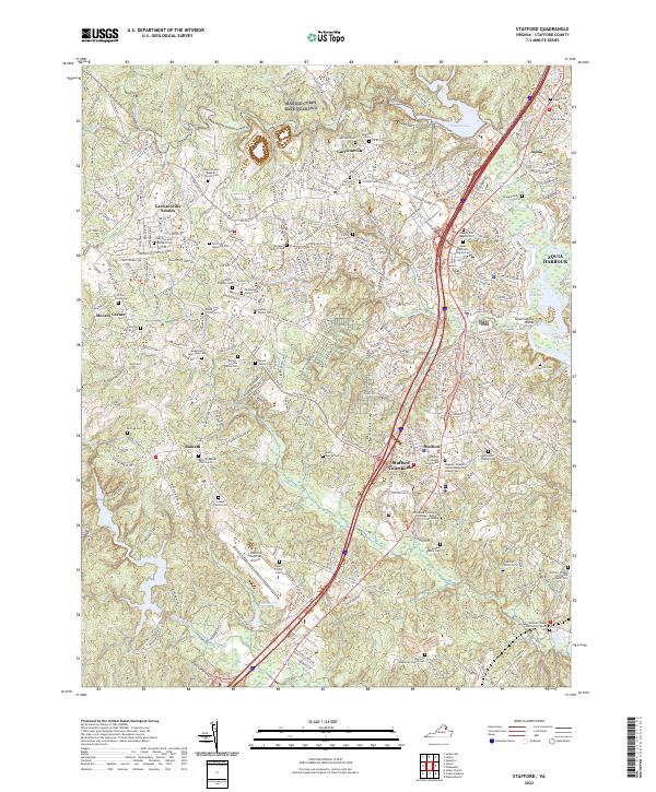
2022 Map of Stafford
USGS Topo · Published 2022About this map
The Stafford County Courthouse serves as the focal point of this Virginia corridor, where established settlements like Stafford and Garrisonville meet modern infrastructure. The landscape is characterized by the winding path of Aquia Creek and the notable Government Island, providing a clear view of the area's transition from colonial roots to a contemporary transit hub. Numerous family burial grounds, such as the Musselman Family Cem and Ball Family Cem, are preserved alongside newer developments like Stafford Memorial Park. This survey illustrates the dense network of roadways connecting the Stafford Regional Airport with local institutions, including the Germanna Community College Barbara J Fried Center and historic religious sites like the Aquia Episcopal Church Cem.
Find a feature on this map
74 named features on this map. Tap any name to fly to it.
Don’t see what you’re looking for? This feature index may not catch every label — zoom into the map to look around manually.
Map Details
Editions of this 2022 Stafford Map
This is the sole edition of this map. No revisions or reprints were ever made.
Other maps of this area

1887 · Spottsylvania
USGS Topo · 1:125,000

1889 · Fredericksburg
USGS Topo · 1:125,000

1890 · Mt. Vernon
USGS Topo · 1:125,000

1891 · Mt. Vernon
USGS Topo · 1:125,000

1892 · Fredericksburg
USGS Topo · 1:125,000

1892 · Spottsylvania
USGS Topo · 1:125,000

1894 · Warrenton
USGS Topo · 1:125,000

1894 · Fredericksburg
USGS Topo · 1:125,000

1894 · Mt. Vernon
USGS Topo · 1:125,000

1897 · Mt. Vernon
USGS Topo · 1:125,000