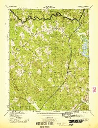
1944 Map of Stafford
USGS Topo · Published 1944About this map
Stafford serves as a central hub in this 1944 Army Corps of Engineers survey, situated at the intersection of the Jefferson Davis Highway and local routes leading to rural clusters like Sheltons Shop and Moores Corner. The landscape is defined by the drainage of Aquia Creek and Accokeek Creek, with the northern reaches of the quadrangle dominated by the U S Marine Corps Reservation. This era of the Virginia countryside is marked by numerous small community centers, often anchored by local houses of worship such as Aquia Ch, Toluca Ch, and Old Andrew Ch.
Find a feature on this map
26 named features on this map. Tap any name to fly to it.
Don’t see what you’re looking for? This feature index may not catch every label — zoom into the map to look around manually.
Map Details
Editions of this 1944 Stafford Map
This is the sole edition of this map. No revisions or reprints were ever made.
Other maps of this area

1887 · Spottsylvania
USGS Topo · 1:125,000

1889 · Fredericksburg
USGS Topo · 1:125,000

1890 · Mt. Vernon
USGS Topo · 1:125,000

1891 · Mt. Vernon
USGS Topo · 1:125,000

1892 · Fredericksburg
USGS Topo · 1:125,000

1892 · Spottsylvania
USGS Topo · 1:125,000

1894 · Warrenton
USGS Topo · 1:125,000

1894 · Fredericksburg
USGS Topo · 1:125,000

1894 · Mt. Vernon
USGS Topo · 1:125,000

1897 · Mt. Vernon
USGS Topo · 1:125,000