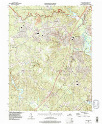
1994 Map of Stafford
USGS Topo · Published 1997About this map
Aquia Harbour and the surrounding Stafford County landscape are documented here during a period of significant suburban development along the Interstate 95 corridor. The map illustrates a mix of modern residential growth in Garrisonville Estates and Garrisonville, contrasted with the historical riverfront character of Coal Landing and Government Island. Along the northern edge, the presence of Camp Barrett and the Quantico Marine Corps Development and Education Command reflects the area's long-standing military associations.
Find a feature on this map
27 named features on this map. Tap any name to fly to it.
Don’t see what you’re looking for? This feature index may not catch every label — zoom into the map to look around manually.
Map Details
Editions of this 1994 Stafford Map
This is the sole edition of this map. No revisions or reprints were ever made.
Other maps of this area

1887 · Spottsylvania
USGS Topo · 1:125,000

1889 · Fredericksburg
USGS Topo · 1:125,000

1890 · Mt. Vernon
USGS Topo · 1:125,000

1891 · Mt. Vernon
USGS Topo · 1:125,000

1892 · Fredericksburg
USGS Topo · 1:125,000

1892 · Spottsylvania
USGS Topo · 1:125,000

1894 · Warrenton
USGS Topo · 1:125,000

1894 · Fredericksburg
USGS Topo · 1:125,000

1894 · Mt. Vernon
USGS Topo · 1:125,000

1897 · Mt. Vernon
USGS Topo · 1:125,000