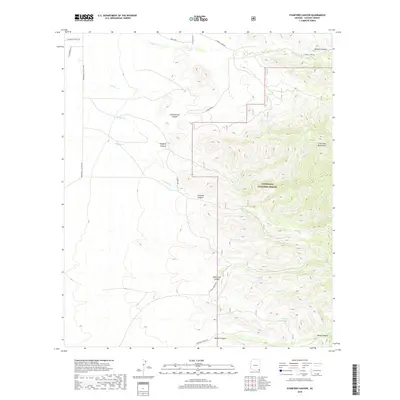
2018 Map of Stanford Canyon
USGS Topo · Published 2018About this map
The Chiricahua Mountains dominate the eastern landscape of this Cochise County survey, where the peaks descend into a series of deeply etched drainages including Stanford Canyon and Pridham Canyon. The western portion of the map transitions into more level terrain, marked by ranch roads like E Winkler Ranch Rd and N Rucker Canyon Rd. This area is defined by its water management features, critical for both livestock and wildlife in the arid climate, evidenced by Turkey Tank, North Tank, and Rusty Tank. A significant portion of the eastern rugged lands is protected within the Coronado National Forest. Genealogists and local historians can trace legacy land divisions across township and range lines, such as t18s r28e, while following the paths of seasonal watercourses like Turkey Cr and Ash Cr. The proximity of John Long Canyon to O'Keefe Spring suggests historic reliance on these scattered water sources for local habitation and transit through the mountain passes.
Find a feature on this map
32 named features on this map. Tap any name to fly to it.
Don’t see what you’re looking for? This feature index may not catch every label — zoom into the map to look around manually.
Map Details
Editions of this 2018 Stanford Canyon Map
This is the sole edition of this map. No revisions or reprints were ever made.
Other maps of this area

1916 · Pearce
USGS Topo · 1:125,000

1917 · Chiricahua
USGS Topo · 1:125,000

1919 · Chiricahua
USGS Topo · 1:125,000

1922 · Swisshelm
USGS Topo · 1:62,500

1926 · Light
USGS Topo · 1:62,500

1926 · Rucker
USGS Topo · 1:62,500

1926 · Pedregosa
USGS Topo · 1:62,500

1955 · Douglas
USGS Topo · 1:250,000

1958 · Chiricahua Peak
USGS Topo · 1:62,500

1958 · Squaretop Hills
USGS Topo · 1:62,500