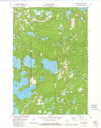
1982 Map of Star Lake
USGS Topo · Published 1982About this map
The settlement of Star Lake anchors this 1982 map of the Northwoods, situated within the extensive Northern Highland-American Legion State Forest. This landscape is defined by its dense concentration of glacial water bodies, from large basins like Lake Laura and Ballard Lake to smaller reaches such as Lake Alva and Eloise Lake. Local history is preserved in features like the Indian Cem near Indian Lake and the Monahan Lookout Tower, which served as a critical vantage point for forest management.
Find a feature on this map
62 named features on this map. Tap any name to fly to it.
Don’t see what you’re looking for? This feature index may not catch every label — zoom into the map to look around manually.
Map Details
Editions of this 1982 Star Lake Map
This is the sole edition of this map. No revisions or reprints were ever made.
Other maps of this area

1930 · Robbins
USGS Topo · 1:48,000

1938 · Minocqua
USGS Topo · 1:48,000

1938 · Robbins
USGS Topo · 1:48,000

1939 · Trout Lake
USGS Topo · 1:48,000

1945 · Robbins
USGS Topo · 1:48,000

1946 · Star Lake
USGS Topo · 1:48,000

1946 · Minocqua
USGS Topo · 1:48,000

1946 · Trout Lake
USGS Topo · 1:48,000

1949 · Trout Lake
USGS Topo · 1:48,000

1949 · Minocqua
USGS Topo · 1:48,000