1949 Map of Minocqua
USGS Topo · Published 1949About this map
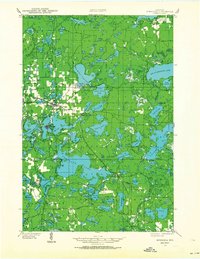
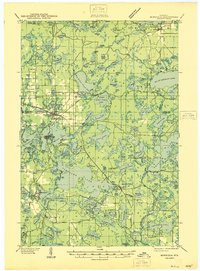
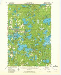
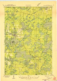
Minocqua and Woodruff form the primary hubs of this lakeland landscape, where the Chicago Milwaukee St Paul and Pacific railroad bisects a network of deep glacial basins. The map illustrates an era of established recreational and conservation land use, featuring the Minocqua Country Club and the Plum Lake Golf Course alongside essential infrastructure like the State Fish Hatchery. To the north, the village of Sayner sits near Big St Germain Lake, while smaller settlements like Hazelhurst and Arbor Vitae are connected by State Hy No 51. The presence of the Lake Tomahawk Fire Tower and Muskellunge Fire Tower underscores the importance of forestry management in this timber-rich region. Local history is anchored by rural landmarks including the Evergreen Cem and several neighborhood schools such as Hall Sch and Hickson Sch, providing a clear view of the mid-century social geography.
Find a feature on this map
143 named features on this map. Tap any name to fly to it.
Don’t see what you’re looking for? This feature index may not catch every label — zoom into the map to look around manually.
Map Details
Editions of this 1949 Minocqua Map
This is the sole edition of this map. No revisions or reprints were ever made.
Historical Maps of Minocqua Through Time
4 maps found