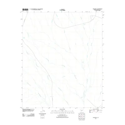
2011 Map of Star Well
USGS Topo · Published 2011About this map
Star Well is a focal point of this arid Maricopa County landscape, where the seasonal hydrology of the Sonoran desert dictates the location of human infrastructure. The map records a complex network of ephemeral drainages, including the prominent Jackrabbit Wash, Star Wash, and Beer Bottle Wash, which converge and diverge across the terrain. These natural paths are punctuated by vital water management features such as Mitchell Tank, Mesquite Tank, and Duck Tank, essential for sustaining life and livestock in this environment.
Find a feature on this map
17 named features on this map. Tap any name to fly to it.
Don’t see what you’re looking for? This feature index may not catch every label — zoom into the map to look around manually.
Map Details
Editions of this 2011 Star Well Map
This is the sole edition of this map. No revisions or reprints were ever made.
Other maps of this area

1954 · Phoenix
USGS Topo · 1:250,000

1957 · Phoenix
USGS Topo · 1:250,000

1957 · White Tank Mts.
USGS Topo · 1:62,500

1958 · Phoenix
USGS Topo · 1:250,000

1960 · Phoenix
USGS Topo · 1:250,000

1961 · Vulture Mountains
USGS Topo · 1:62,500

1962 · Belmont Mts
USGS Topo · 1:62,500
1965 · Wickenburg SW
USGS Topo · 1:24,000

1969 · Phoenix
USGS Topo · 1:250,000
1971 · Phoenix
USGS Topo · 1:250,000