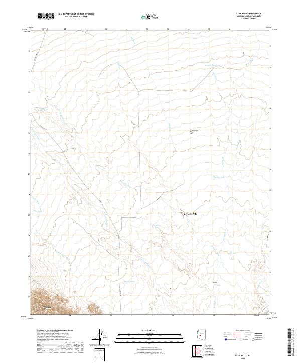
2021 Map of Star Well
USGS Topo · Published 2021About this map
The Hassayampa Plain dominates this landscape in Maricopa County, characterized by a complex network of desert drainages including Beer Bottle Wash, Jackrabbit Wash, and Sunnie Wash. This arid region, part of the Buckeye area, shows a distribution of water sources critical for ranching or survival, such as Mesquite Tank, Hidden Tank, and Mitchell Tank. To the southwest, the terrain rises into the foothills of the Belmont Mountains. Transportation across this section of the desert is defined by historically significant routes like Aguila Rd and Vulture Mine Rd, which once connected remote desert outposts and mining operations. The eponymous Star Well serves as a primary landmark in the southeastern portion of the map, illustrating the continued reliance on localized groundwater points in the Arizona backcountry.
Find a feature on this map
28 named features on this map. Tap any name to fly to it.
Don’t see what you’re looking for? This feature index may not catch every label — zoom into the map to look around manually.
Map Details
Editions of this 2021 Star Well Map
This is the sole edition of this map. No revisions or reprints were ever made.
Other maps of this area

1954 · Phoenix
USGS Topo · 1:250,000

1957 · Phoenix
USGS Topo · 1:250,000

1957 · White Tank Mts.
USGS Topo · 1:62,500

1958 · Phoenix
USGS Topo · 1:250,000

1960 · Phoenix
USGS Topo · 1:250,000

1961 · Vulture Mountains
USGS Topo · 1:62,500

1962 · Belmont Mts
USGS Topo · 1:62,500
1965 · Wickenburg SW
USGS Topo · 1:24,000

1969 · Phoenix
USGS Topo · 1:250,000
1971 · Phoenix
USGS Topo · 1:250,000