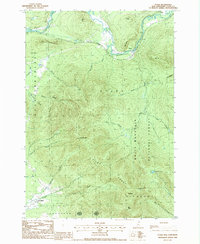
1988 Map of Stark
USGS Topo · Published 1988About this map
The Upper Ammonoosuc River carves a path through this mountainous section of Coos County, defining the valley where the small settlements of Stark and Percy are located. This terrain is dominated by the northern reaches of the White Mountain National Forest, including the prominent peaks of the Pilot Range. Significant elevations such as Mt Cabot, The Horn, and The Bulge create a complex series of drainage basins for numerous mountain streams like Roaring Brook and Mill Brook.
Find a feature on this map
38 named features on this map. Tap any name to fly to it.
Don’t see what you’re looking for? This feature index may not catch every label — zoom into the map to look around manually.
Map Details
Editions of this 1988 Stark Map
2 editions found
Other maps of this area

1893 · Mt. Washington
USGS Topo · 1:62,500

1896 · Mt. Washington
USGS Topo · 1:62,500

1900 · Whitefield
USGS Topo · 1:62,500

1920 · Guildhall
USGS Topo · 1:62,500

1930 · Percy
USGS Topo · 1:62,500

1931 · Guildhall
USGS Topo · 1:48,000

1933 · Guildhall
USGS Topo · 1:48,000

1934 · Percy
USGS Topo · 1:62,500

1935 · Whitefield
USGS Topo · 1:48,000

1935 · Mt. Washington
USGS Topo · 1:62,500