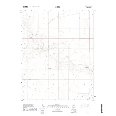
2020 Map of Stead
USGS Topo · Published 2020About this map
Stead serves as the primary focal point of this high plains landscape in northeastern New Mexico. This region is characterized by a sparse network of county roads and the winding path of Tramperos Creek, which cuts through the terrain. The presence of a Po in Stead indicates its role as a local gathering point and service hub for the surrounding ranching community. The road network, including Stead Rd, Bush Rd, and Proffitt Rd, follows the established sections of the Public Land Survey System, illustrating the orderly division of the territory into townships like t22n r35e. The landscape's topography is defined by the drainage basin of Tramperos Creek, where subtle elevation changes reveal the movement of water across this arid environment.
Find a feature on this map
20 named features on this map. Tap any name to fly to it.
Don’t see what you’re looking for? This feature index may not catch every label — zoom into the map to look around manually.
Map Details
Editions of this 2020 Stead Map
This is the sole edition of this map. No revisions or reprints were ever made.
Other maps of this area

1954 · Tucumcari
USGS Topo · 1:250,000

1954 · Dalhart
USGS Topo · 1:250,000

1958 · Tucumcari
USGS Topo · 1:250,000

1958 · Dalhart
USGS Topo · 1:250,000

1962 · Dalhart
USGS Topo · 1:250,000

1966 · Skull Mesa
USGS Topo · 1:24,000

1966 · Clapham
USGS Topo · 1:24,000

1966 · Hayden
USGS Topo · 1:24,000

1970 · Stead
USGS Topo · 1:24,000

1970 · Sedan
USGS Topo · 1:24,000