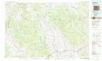
1980 Map of Steamboat Springs
USGS Topo · Published 1982About this map
The Yampa River valley and the high alpine terrain of the Gore Range define this 1980 survey, showing the established communities of northwest Colorado during a period of mountain expansion. The Denver and Rio Grande Western railroad connects the mining and ranching hubs of Oak Creek, Phippsburg, and Yampa, tracing a route through the heart of Routt National Forest.
Find a feature on this map
67 named features on this map. Tap any name to fly to it.
Don’t see what you’re looking for? This feature index may not catch every label — zoom into the map to look around manually.
Map Details
Editions of this 1980 Steamboat Springs Map
This is the sole edition of this map. No revisions or reprints were ever made.
Other maps of this area

1911 · Hahns Peak
USGS Topo · 1:125,000

1913 · Hahns Peak
USGS Topo · 1:125,000

1915 · Longs Peak
USGS Topo · 1:125,000

1916 · Home
USGS Topo · 1:125,000

1919 · Rocky Mountain National Park
USGS Topo · 1:125,000

1920 · Home
USGS Topo · 1:125,000

1923 · Pilot Knob
USGS Topo · 1:62,500

1924 · Mt. Harris
USGS Topo · 1:48,000

1924 · Fraser
USGS Topo · 1:62,500

1925 · Pilot Knob
USGS Topo · 1:62,500