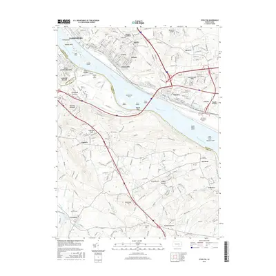
2016 Map of Steelton
USGS Topo · Published 2016About this map
The Susquehanna River serves as the dominant geographical spine for this region, separating the urban centers of Harrisburg and Steelton in Dauphin County from the riverfront communities in Cumberland County and York County. This map details a dense industrial and transport corridor where the Pennsylvania Canal and the Norfolk Southern rail lines parallel the river's eastern bank. A chain of river islands, including Hess Island, Stucker Island, and Zimmerman Island, breaks the wide flow of the Susquehanna between the Steelton steel works and the western heights.
Find a feature on this map
260 named features on this map. Tap any name to fly to it.
Don’t see what you’re looking for? This feature index may not catch every label — zoom into the map to look around manually.
Map Details
Editions of this 2016 Steelton Map
This is the sole edition of this map. No revisions or reprints were ever made.
Other maps of this area

1892 · Hummelstown
USGS Topo · 1:62,500

1892 · Harrisburg
USGS Topo · 1:62,500

1899 · Harrisburg
USGS Topo · 1:62,500

1906 · New Cumberland
USGS Topo · 1:62,500

1908 · Middletown
USGS Topo · 1:62,500

1924 · Hummelstown
USGS Topo · 1:62,500

1924 · Harrisburg
USGS Topo · 1:62,500

1943 · New Cumberland
USGS Topo · 1:62,500

1943 · Middletown
USGS Topo · 1:62,500

1943 · Harrisburg
USGS Topo · 1:62,500