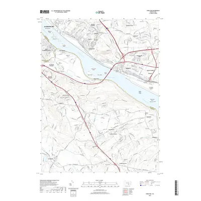
2019 Map of Steelton
USGS Topo · Published 2019About this map
The Susquehanna River dominates this landscape, serving as a historic boundary between Dauphin and York counties. Near the industrial riverfront, the remnants of the Pennsylvania Canal sit alongside the established boroughs of Steelton and Highspire. This 2019 survey documents a region where modern aviation hubs like the Harrisburg International Airport and Capital City Airport coexist with deep-rooted community markers. For genealogists, the map is remarkably dense with burial grounds, ranging from the Stoner Family Farm Cem and Shopes Mennonite Cem to the Goldsboro Cemeteries. The transition from the urban density of Harrisburg and New Cumberland to the residential character of Valley Green and Swatara Crest reflects the ongoing development of the state capital's periphery, while the series of river islands, including Sheesly Island and Zimmerman Island, maintain a natural buffer between the shorelines.
Find a feature on this map
78 named features on this map. Tap any name to fly to it.
Don’t see what you’re looking for? This feature index may not catch every label — zoom into the map to look around manually.
Map Details
Editions of this 2019 Steelton Map
This is the sole edition of this map. No revisions or reprints were ever made.
Other maps of this area

1892 · Hummelstown
USGS Topo · 1:62,500

1892 · Harrisburg
USGS Topo · 1:62,500

1899 · Harrisburg
USGS Topo · 1:62,500

1906 · New Cumberland
USGS Topo · 1:62,500

1908 · Middletown
USGS Topo · 1:62,500

1924 · Hummelstown
USGS Topo · 1:62,500

1924 · Harrisburg
USGS Topo · 1:62,500

1943 · New Cumberland
USGS Topo · 1:62,500

1943 · Middletown
USGS Topo · 1:62,500

1943 · Harrisburg
USGS Topo · 1:62,500