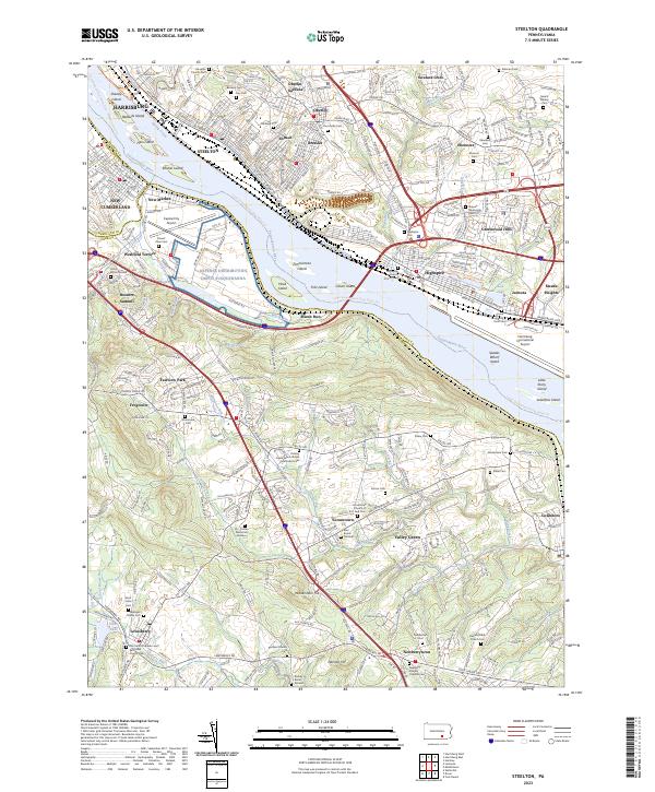
2023 Map of Steelton
USGS Topo · Published 2023About this map
The Susquehanna River dominates this landscape south of Harrisburg, winding past a series of named landforms including Zimmerman Island, Fritz Island, and Spades Wharf Island. The historic path of the Pennsylvania Canal remains visible along the eastern bank, tracing a legacy of early transport alongside modern hubs like the Harrisburg International Airport and Capital City Airport.
Find a feature on this map
121 named features on this map. Tap any name to fly to it.
Don’t see what you’re looking for? This feature index may not catch every label — zoom into the map to look around manually.
Map Details
Editions of this 2023 Steelton Map
This is the sole edition of this map. No revisions or reprints were ever made.
Other maps of this area

1892 · Hummelstown
USGS Topo · 1:62,500

1892 · Harrisburg
USGS Topo · 1:62,500

1899 · Harrisburg
USGS Topo · 1:62,500

1906 · New Cumberland
USGS Topo · 1:62,500

1908 · Middletown
USGS Topo · 1:62,500

1924 · Hummelstown
USGS Topo · 1:62,500

1924 · Harrisburg
USGS Topo · 1:62,500

1943 · New Cumberland
USGS Topo · 1:62,500

1943 · Middletown
USGS Topo · 1:62,500

1943 · Harrisburg
USGS Topo · 1:62,500