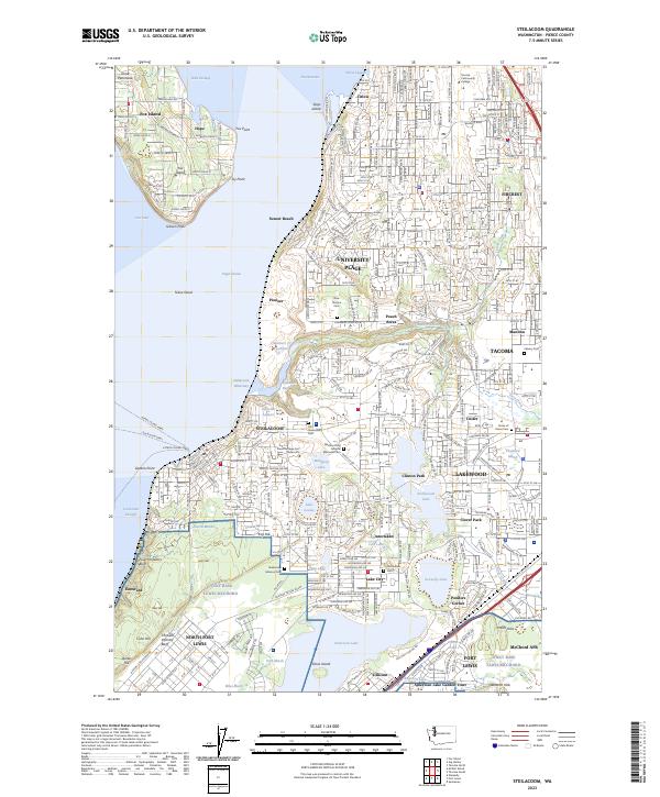
2023 Map of Steilacoom
USGS Topo · Published 2023About this map
Joint Base Lewis-Mcchord and North Fort Lewis dominate the southern portion of this Pierce County landscape, reflecting a long-standing military presence near the shoreline of Puget Sound. The map documents a dense suburban and institutional network, including the expansive grounds of Pierce College Fort Steilacoom and the Western State Hospital Memorial Cem. In Steilacoom, the historic waterfront serves as a critical transit hub for the Steilacoom Ferry and Mcneil Island Ferry routes across Cormorant Passage.
Find a feature on this map
78 named features on this map. Tap any name to fly to it.
Don’t see what you’re looking for? This feature index may not catch every label — zoom into the map to look around manually.
Map Details
Editions of this 2023 Steilacoom Map
This is the sole edition of this map. No revisions or reprints were ever made.
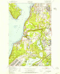
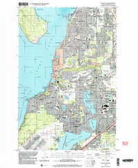
Historical Maps of Fox Glen Through Time
4 maps found