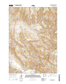
2014 Map of Stemler Ridge
USGS Topo · Published 2014About this map
The settlement of Juntura sits at the southern edge of this high-desert landscape where the Malheur River and the North Fork Malheur River converge. This 2014 survey captures a terrain defined by complex water management, featuring a network of livestock waterholes and catchments such as Beulah Cr Reservoir and Stemler Ridge Reservoir. To the south, the Townsite Ditch and the Juntura Investment Company Canal illustrate the engineering required to support valley agriculture in this arid environment.
Find a feature on this map
53 named features on this map. Tap any name to fly to it.
Don’t see what you’re looking for? This feature index may not catch every label — zoom into the map to look around manually.
Map Details
Editions of this 2014 Stemler Ridge Map
This is the sole edition of this map. No revisions or reprints were ever made.
Other maps of this area

1955 · Burns
USGS Topo · 1:250,000

1955 · Boise
USGS Topo · 1:250,000

1958 · Burns
USGS Topo · 1:250,000

1958 · Boise
USGS Topo · 1:250,000

1959 · Burns
USGS Topo · 1:250,000

1962 · Boise
USGS Topo · 1:250,000

1966 · Westfall Butte
USGS Topo · 1:62,500

1966 · Beulah
USGS Topo · 1:62,500
1972 · Monument Peak
USGS Topo · 1:24,000
1978 · Juntura
USGS Topo · 1:24,000