
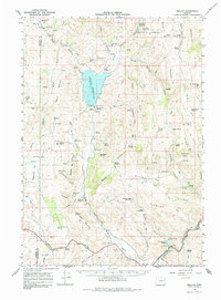
1966 Map of Beulah
USGS Topo · Published 1971About this map
The North Fork Malheur River defines the central axis of this Oregon landscape, anchored by the Beulah Reservoir and the Agency Valley Dam. This 1966 topographic study captures the infrastructure of the high desert, including the Gaging Station and various reservoirs like Murphy Reservoir and Goldy Reservoir that managed water for the region. A notable cultural landmark is the Old Indian Treaty Boundary which cuts across the northern terrain near Castle Rock. Local history is preserved at the Agency Valley Cem near the small settlement of Beulah, while the southern reaches of the map show the transition toward the Union Pacific River corridor near Horseshoe Bend. The map is also dense with named natural springs, including Springs (Hot) and Moonshine Spring, which provided essential water sources in the arid environment between Agency Mountain and Bendire Mtn.
Find a feature on this map
95 named features on this map. Tap any name to fly to it.
Don’t see what you’re looking for? This feature index may not catch every label — zoom into the map to look around manually.
Map Details
Editions of this 1966 Beulah Map
2 editions found
Other maps of this area

1908 · Ironside Mountain
USGS Topo · 1:125,000

1955 · Baker
USGS Topo · 1:250,000

1955 · Burns
USGS Topo · 1:250,000

1955 · Canyon City
USGS Topo · 1:250,000

1955 · Boise
USGS Topo · 1:250,000

1958 · Burns
USGS Topo · 1:250,000

1958 · Boise
USGS Topo · 1:250,000

1959 · Baker
USGS Topo · 1:250,000

1959 · Burns
USGS Topo · 1:250,000

1959 · Canyon City
USGS Topo · 1:250,000